Approximate Location Map
Large Map »
Latitude: 51.4869 / 51°29'12"N
Longitude: -0.6087 / 0°36'31"W
OS Eastings: 496699
OS Northings: 177351
OS Grid: SU966773
Mapcode National: GBR F8D.NYB
Mapcode Global: VHFT8.DWKK
Plus Code: 9C3XF9PR+PG
Entry Name: 58, High Street
Listing Date: 14 May 1973
Grade: II
Source: Historic England
Source ID: 1211366
English Heritage Legacy ID: 395842
ID on this website: 101211366
Location: Eton, Windsor and Maidenhead, Berkshire, SL4
County: Windsor and Maidenhead
Civil Parish: Eton
Built-Up Area: Eton
Traditional County: Buckinghamshire
Lieutenancy Area (Ceremonial County): Berkshire
Church of England Parish: Eton
Church of England Diocese: Oxford
Tagged with: Building
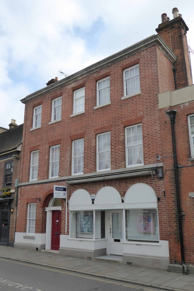
1. HIGH STREET
1909 (East Side)
No 58
SU 9677 SE 2/64
II
2.
Early C19. Red brick, stone dressings. 3 storeys, plinth, first floor sill band,
cornice and blocking course. 5 sashes with glazing bars in reveals under flat
arches. Left central doorway; 4 fielded panel door, fanlight, fluted Greek Doric
columns, all in arched panel. Modern shop on right has 3 dummy arches.
Listing NGR: SU9669977351
External links are from the relevant listing authority and, where applicable, Wikidata. Wikidata IDs may be related buildings as well as this specific building. If you want to add or update a link, you will need to do so by editing the Wikidata entry.


Other nearby listed buildings
