Latitude: 51.5293 / 51°31'45"N
Longitude: -0.2117 / 0°12'42"W
OS Eastings: 524144
OS Northings: 182675
OS Grid: TQ241826
Mapcode National: GBR BD.C9M
Mapcode Global: VHGQR.8TXG
Plus Code: 9C3XGQHQ+P8
Entry Name: 67-81, Fifth Avenue W10
Listing Date: 1 December 1987
Grade: II
Source: Historic England
Source ID: 1211883
English Heritage Legacy ID: 209721
ID on this website: 101211883
Location: West Kilburn, Westminster, London, W10
County: London
District: City of Westminster
Civil Parish: Queen's Park
Built-Up Area: City of Westminster
Traditional County: Middlesex
Lieutenancy Area (Ceremonial County): Greater London
Church of England Parish: St John Kensal Green
Church of England Diocese: London
Tagged with: Building
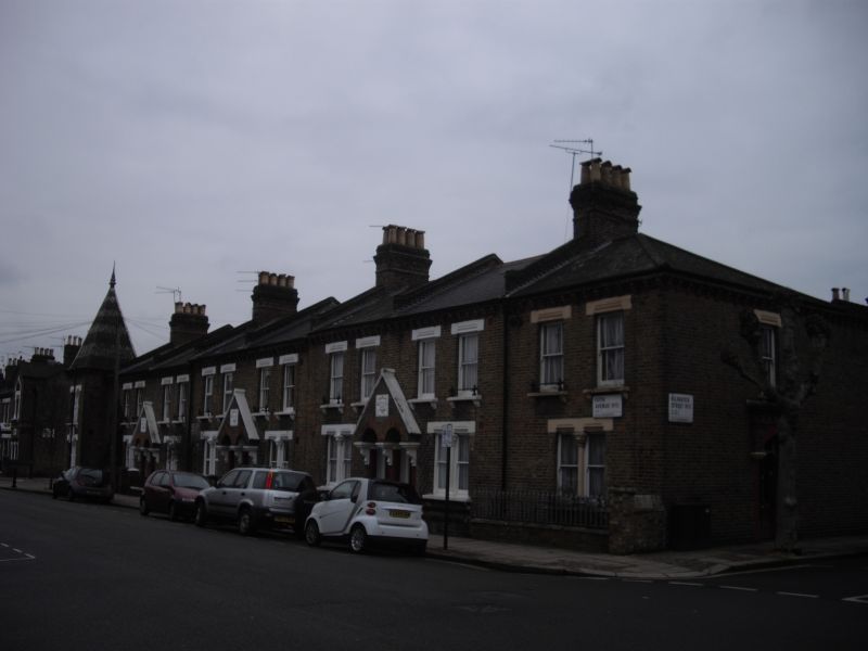
TQ 2482 NW CITY OF WESTMINSTER FIFTH AVENUE, W10 17/6 (west side) Nos 67 to 81 (odd) GV II Terrace. 1880 on plaque. By Austin and Roland Plumbe. For Queen's Park Estate of the Artisans, Labourers and General Dwellings Company. Yellow brick in Flemish bond with irregular red brick banding and detailing. Welsh slate roof with bands of fish-scale tiling to 'tower' roof. 2 storeys, each house 2 bays with 2-bay projecting end block to south with pyramidal roof forming tower feature. Free Gothic style. Gabled porches on corbels contain paired entrances with half-glazed doors with overlights under red gauged brick keyed arches. Ceramic date plaque to porch gable and painted coping. Paired sashes with dividing colonette and painted lintels. Above, sashes, some with margin lights with sills on corbels and painted lintels. Moulded brick eaves course. Coping to party walls and corniced stacks. End house to south has entrance to return wall and is treated as tower with paired sashes to both floors and pyramidal roof with finial. This terrace, together with Nos 83-97, 68-82, 84-98 (qv) forms a balanced group of terraces with 'tower' features to north and south which forms in turn part of the main street of the Estate.
Listing NGR: TQ2414482675
External links are from the relevant listing authority and, where applicable, Wikidata. Wikidata IDs may be related buildings as well as this specific building. If you want to add or update a link, you will need to do so by editing the Wikidata entry.


Other nearby listed buildings