Latitude: 51.4014 / 51°24'4"N
Longitude: -1.3225 / 1°19'21"W
OS Eastings: 447223
OS Northings: 167145
OS Grid: SU472671
Mapcode National: GBR 81Z.2FM
Mapcode Global: VHCZK.115J
Plus Code: 9C3WCM2G+HX
Entry Name: 7 and 9, Wharf Street
Listing Date: 2 September 1983
Grade: II
Source: Historic England
Source ID: 1211903
English Heritage Legacy ID: 396433
ID on this website: 101211903
Location: Newbury, West Berkshire, RG14
County: West Berkshire
Civil Parish: Newbury
Built-Up Area: Newbury
Traditional County: Berkshire
Lieutenancy Area (Ceremonial County): Berkshire
Church of England Parish: Newbury St Nicolas
Church of England Diocese: Oxford
Tagged with: Building
1. WHARF STREET 5127 Nos 7 and 9 SU 4767 SW 6/228
II GV
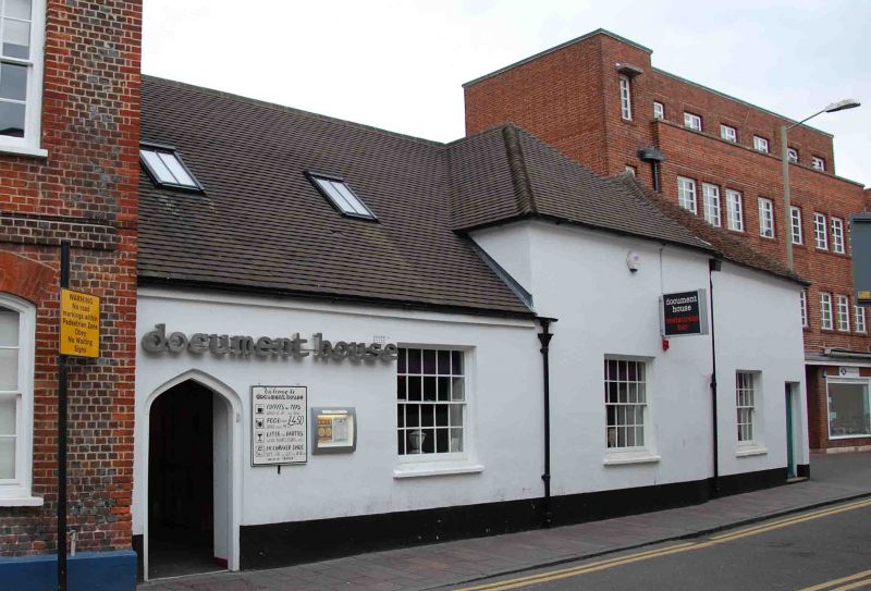
2. Circa 1830, stables of No 5 Wharf Street (qv). Built on site of north range of Cloth Hall demolished circa 1829. One storey. No 7, 2 windows; No 9, 1 window. Irregular hipped tile roofs. Rendered fronts, recessed sash windows with glazing bars. No 7, 4 centred arched doorway; No 9, modern entrance. Included for group value.
Listing NGR: SU4722567151
External links are from the relevant listing authority and, where applicable, Wikidata. Wikidata IDs may be related buildings as well as this specific building. If you want to add or update a link, you will need to do so by editing the Wikidata entry.


Other nearby listed buildings