Latitude: 52.8006 / 52°48'2"N
Longitude: -2.1122 / 2°6'43"W
OS Eastings: 392533
OS Northings: 322563
OS Grid: SJ925225
Mapcode National: GBR 288.DTC
Mapcode Global: WHBDT.JVFW
Plus Code: 9C4VRV2Q+64
Entry Name: Stable Block Approximately 8 Metres North of Greenfields
Listing Date: 16 February 1994
Grade: II
Source: Historic England
Source ID: 1212050
English Heritage Legacy ID: 383977
ID on this website: 101212050
Location: Forebridge, Stafford, Staffordshire, ST17
County: Staffordshire
District: Stafford
Electoral Ward/Division: Forebridge
Parish: Non Civil Parish
Built-Up Area: Stafford
Traditional County: Staffordshire
Lieutenancy Area (Ceremonial County): Staffordshire
Church of England Parish: Stafford St Paul, Forebridge
Church of England Diocese: Lichfield
Tagged with: Stable
STAFFORD
SJ9222NE GARDEN STREET 590-1/12/35 (West side) Stable block approximately 8 metres north of Greenfields
GV II
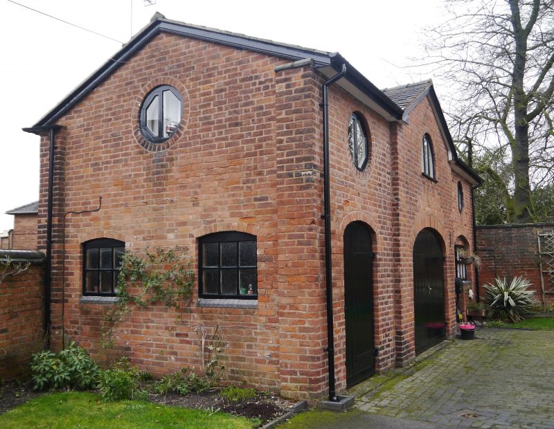
Stable block. c1830. Brick with slate roof. Rectangular structure. Single storey with loft; 3-window range; centre breaks forward under gable. Elliptical-headed carriage entrance to centre, similar entrance to left and later entrance to right; loft has central lunette window, pitching eye with small-paned glazing to left, and similar square opening to right. Left return has 2 segmental-headed entrances and pitching eye above. Rear has elliptical-headed entrance with pitching eye above and carriage entrance with sliding door to right; end lateral stack. A good and rare survival of a domestic stable block forming important element on street corner.
Listing NGR: SJ9253322563
External links are from the relevant listing authority and, where applicable, Wikidata. Wikidata IDs may be related buildings as well as this specific building. If you want to add or update a link, you will need to do so by editing the Wikidata entry.


Other nearby listed buildings