Latitude: 51.9242 / 51°55'27"N
Longitude: -0.9261 / 0°55'33"W
OS Eastings: 473946
OS Northings: 225617
OS Grid: SP739256
Mapcode National: GBR C03.6PL
Mapcode Global: VHDTH.WWST
Plus Code: 9C3XW3FF+MH
Entry Name: White House Farmhouse
Listing Date: 4 June 1952
Grade: II
Source: Historic England
Source ID: 1212147
English Heritage Legacy ID: 396651
ID on this website: 101212147
Location: East Claydon, Buckinghamshire, MK18
County: Buckinghamshire
Civil Parish: East Claydon
Traditional County: Buckinghamshire
Lieutenancy Area (Ceremonial County): Buckinghamshire
Church of England Parish: The Claydons
Church of England Diocese: Oxford
Tagged with: Farmhouse
SP 72 NW EAST CLAYDON CHURCH WAY
1/17 White House Farmhouse.
4.6.52
G.V. II
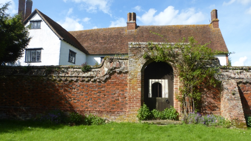
House. C16-C17, altered. Whitewashed roughcast, probably over timber frame, some framing exposed to left side. Rubble stone plinth. Old tile roof. Chimney stacks of thin brick with square shafts set diagonally, 2 to left side and right gable, 4 to centre. L-plan. 2 storeys and attic, first floor of main wing jettied over plaster cove with moulded wall plate and bressumer. 4 bays, that to left projecting to front and gabled with modillioned bargeboards. 3-light leaded casements, those to first floor with moulded wooden cornice tops. Left bay has smaller similar window to attic of front gable, canted bay window with leaded lights and transoms to right-hand return wall and C20 door in angle with main wing. Third bay has C16 door, boarded and studded, in moulded frame, and porch dated 1662 EVM 1894. Porch is of ashlar to front and thin brick to sides, and has 4-centred arch with shields to spandrels,fluted Doric pilasters on panelled plinths, moulded entablature continued round sides, and pediment. Single leaded light to left of porch. Centre of range has ashlar niche with shallow arched head. Interior: projecting wing has stone fireplace with 4-centred arch to ground floor.
RCHM II p. 103 Mon.2.
Listing NGR: SP7394625617
External links are from the relevant listing authority and, where applicable, Wikidata. Wikidata IDs may be related buildings as well as this specific building. If you want to add or update a link, you will need to do so by editing the Wikidata entry.


Other nearby listed buildings