Approximate Location Map
Large Map »
Latitude: 50.3395 / 50°20'22"N
Longitude: -4.7929 / 4°47'34"W
OS Eastings: 201357
OS Northings: 52574
OS Grid: SX013525
Mapcode National: GBR ZX.9QCP
Mapcode Global: FRA 08V4.GLB
Plus Code: 9C2Q86Q4+RR
Entry Name: Elm Terrace
Listing Date: 7 May 1976
Grade: II
Source: Historic England
Source ID: 1212569
English Heritage Legacy ID: 397002
ID on this website: 101212569
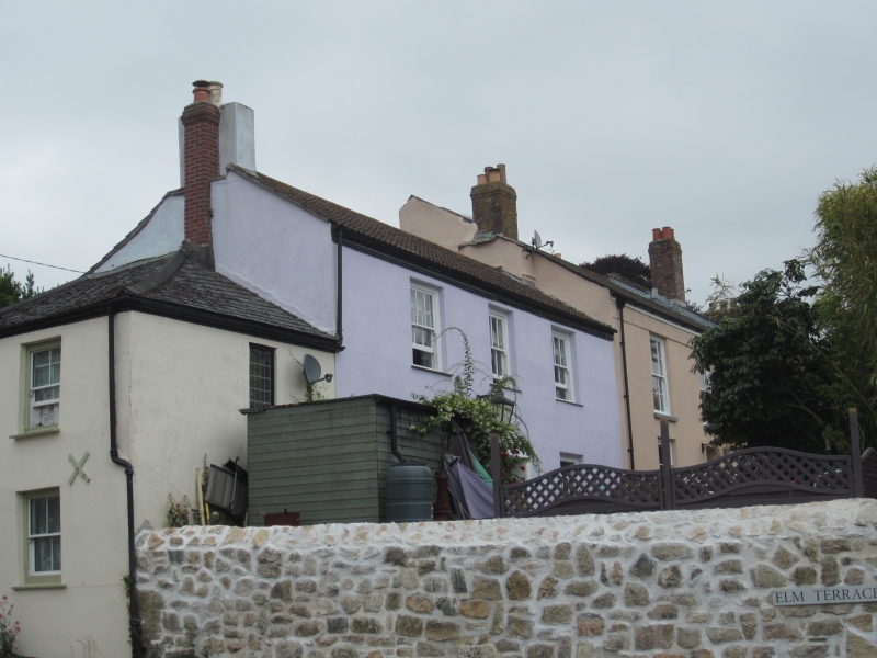
ST AUSTELL
1. NORTH STREET
1584A
No 1 Elm Terrace
SX 0152 1/515
II GV
2.
Early-mid C19. Stucco. Two storeys. Three sash windows without glazing bars. Moulded
wood eaves. Modern roof.
Nos 1 to 5 (consec) Elm Terrace form a group.
Listing NGR: SX0135852572
External links are from the relevant listing authority and, where applicable, Wikidata. Wikidata IDs may be related buildings as well as this specific building. If you want to add or update a link, you will need to do so by editing the Wikidata entry.


Other nearby listed buildings
