Approximate Location Map
Large Map »
Latitude: 50.2363 / 50°14'10"N
Longitude: -3.7674 / 3°46'2"W
OS Eastings: 274051
OS Northings: 38856
OS Grid: SX740388
Mapcode National: GBR QH.FPVN
Mapcode Global: FRA 380D.L3K
Plus Code: 9C2R66PM+G2
Entry Name: The Grange
Listing Date: 3 May 1949
Grade: II*
Source: Historic England
Source ID: 1212730
English Heritage Legacy ID: 397220
ID on this website: 101212730
Location: Salcombe, South Hams, Devon, TQ8
County: Devon
District: South Hams
Civil Parish: Salcombe
Built-Up Area: Salcombe
Traditional County: Devon
Lieutenancy Area (Ceremonial County): Devon
Church of England Parish: Salcombe Holy Trinity
Church of England Diocese: Exeter
Tagged with: Building
1.
1591 CLIFF ROAD
(West Side)
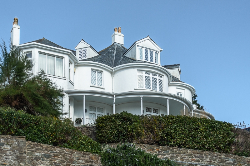
The Grange
SX 7438 1/13 3.5.49.
II*
2.
Late C18 2 storey house standing above road, probably originally thatched,
now has slate roof with gabled dormers Stucco front consists of 3 segmental
bows with continuous verandah on slender columns.
Listing NGR: SX7405138856
External links are from the relevant listing authority and, where applicable, Wikidata. Wikidata IDs may be related buildings as well as this specific building. If you want to add or update a link, you will need to do so by editing the Wikidata entry.


Other nearby listed buildings
