Latitude: 51.4308 / 51°25'50"N
Longitude: -1.2247 / 1°13'29"W
OS Eastings: 453992
OS Northings: 170479
OS Grid: SU539704
Mapcode National: GBR 931.95R
Mapcode Global: VHCZD.Q9DJ
Plus Code: 9C3WCQJG+84
Entry Name: Hillhouse Farmhouse
Listing Date: 29 November 1983
Grade: II
Source: Historic England
Source ID: 1213093
English Heritage Legacy ID: 397613
ID on this website: 101213093
Location: The Slade, West Berkshire, RG7
County: West Berkshire
Civil Parish: Bucklebury
Traditional County: Berkshire
Lieutenancy Area (Ceremonial County): Berkshire
Church of England Parish: Bucklebury
Church of England Diocese: Oxford
Tagged with: Farmhouse
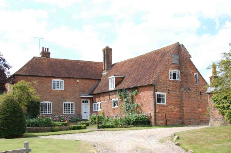
BUCKLEBURY SU 57 SW 5/13 Hillhouse farmhouse - II Farmhouse. Circa 1600 with some C19 refacing and large C19 wing to south. Brick, timber framed with brick nogging, some later brick refacing. Old tile roof, hipped over projecting wing to left with stack off-centre to left, stack to right and C20 dormer with casements. L-plan: 3 framed bays of one storey and attic with large C19 two storey wing projecting to left. East front: brick faced bay to right, 2-light C19 casement in centre bay and 5-light C19 casement in left-hand bay. Projecting wing, right-hand return wall: one first floor 3-light segemental headed casement and 2 ground floor 3-light segmental headed casements to left. 5-panelled door to right with rectangular overlight under segmental head and C20 porch. Interior: frame includes one pair of cruck blades.
Listing NGR: SU5399270479
External links are from the relevant listing authority and, where applicable, Wikidata. Wikidata IDs may be related buildings as well as this specific building. If you want to add or update a link, you will need to do so by editing the Wikidata entry.


Other nearby listed buildings