Approximate Location Map
Large Map »
Latitude: 51.0316 / 51°1'53"N
Longitude: -3.703 / 3°42'10"W
OS Eastings: 280680
OS Northings: 127184
OS Grid: SS806271
Mapcode National: GBR L6.HCQJ
Mapcode Global: FRA 364D.76S
Plus Code: 9C3R27JW+JR
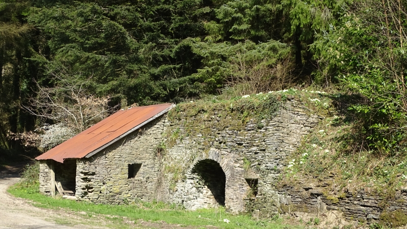
Entry Name: Limekiln at SS 8069 2718
Listing Date: 24 November 1988
Grade: II
Source: Historic England
Source ID: 1213800
English Heritage Legacy ID: 398438
ID on this website: 101213800
Location: North Devon, EX36
County: Devon
District: North Devon
Civil Parish: Molland
Traditional County: Devon
Lieutenancy Area (Ceremonial County): Devon
Church of England Parish: Molland St Mary
Church of England Diocese: Exeter
Tagged with: Lime kiln
MOLLAND ZEAL QUARRY
SS 82 NW
15/107 Limekiln at SS 8069 2718
- II
Limekiln. Probably late C18 or early C19. Battered coursed stone rubble walls.
Segmental-arched opening with rubble voussoirs and lower segmental arch set back
within. Bowed back wall with opening from above.
Listing NGR: SS8068027184
External links are from the relevant listing authority and, where applicable, Wikidata. Wikidata IDs may be related buildings as well as this specific building. If you want to add or update a link, you will need to do so by editing the Wikidata entry.


Other nearby listed buildings
