Approximate Location Map
Large Map »
Latitude: 51.7761 / 51°46'33"N
Longitude: -0.9907 / 0°59'26"W
OS Eastings: 469728
OS Northings: 209080
OS Grid: SP697090
Mapcode National: GBR B0F.NB0
Mapcode Global: VHDV7.SM3B
Plus Code: 9C3XQ2G5+CP
Entry Name: 65, High Street
Listing Date: 25 October 1951
Last Amended: 19 June 1981
Grade: II
Source: Historic England
Source ID: 1213826
English Heritage Legacy ID: 398477
ID on this website: 101213826
Location: Long Crendon, Buckinghamshire, HP18
County: Buckinghamshire
Civil Parish: Long Crendon
Built-Up Area: Long Crendon
Traditional County: Buckinghamshire
Lieutenancy Area (Ceremonial County): Buckinghamshire
Church of England Parish: Long Crendon
Church of England Diocese: Oxford
Tagged with: Building
1.
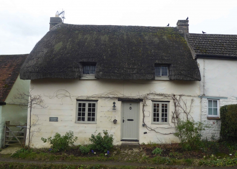
5132 LONG CRENDON HIGH STREET
(west side)
No 65 (formerly listed
as 'Cottage at Church End
occupied by J Buckle')
SP 6909 1/76 25.10.51
II GV
2.
C18. One storey and attic. Colour washed rendering on stone and witchert.
Thatch. Door off-centre with 2-light modern casement each side. Two small
leaded casements in thatch.
Listing NGR: SP6972709078
External links are from the relevant listing authority and, where applicable, Wikidata. Wikidata IDs may be related buildings as well as this specific building. If you want to add or update a link, you will need to do so by editing the Wikidata entry.


Other nearby listed buildings
