Approximate Location Map
Large Map »
Latitude: 54.3956 / 54°23'44"N
Longitude: -0.9198 / 0°55'11"W
OS Eastings: 470234
OS Northings: 500552
OS Grid: NZ702005
Mapcode National: GBR QK0M.N2
Mapcode Global: WHF91.VS64
Plus Code: 9C6X93WJ+63
Entry Name: Guidestone
Listing Date: 27 August 1987
Grade: II
Source: Historic England
Source ID: 1213929
English Heritage Legacy ID: 382485
ID on this website: 101213929
Location: North Yorkshire, YO18
County: North Yorkshire
District: Ryedale
Civil Parish: Rosedale East Side
Traditional County: Yorkshire
Lieutenancy Area (Ceremonial County): North Yorkshire
Tagged with: Milestone
ROSEDALE EAST SIDE ROSEDALE HEAD ROAD
NZ 70 SW
(south-west side, off)
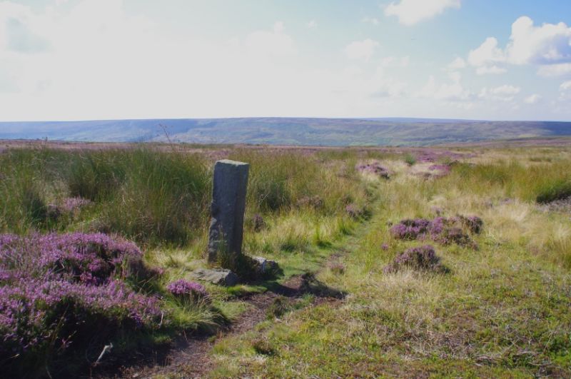
2/67 Guidestone
- II
Guidestone. Early C18. Sandstone. Rectangular post approximately
1.3 metres high. The west face is inscribed "ROSDALE" (sic), the east face
"WHITBY".
Listing NGR: NZ7023400552
External links are from the relevant listing authority and, where applicable, Wikidata. Wikidata IDs may be related buildings as well as this specific building. If you want to add or update a link, you will need to do so by editing the Wikidata entry.


Other nearby listed buildings
