Latitude: 51.348 / 51°20'52"N
Longitude: -0.2496 / 0°14'58"W
OS Eastings: 522000
OS Northings: 162442
OS Grid: TQ220624
Mapcode National: GBR 9X.V1T
Mapcode Global: VHGRP.MCDZ
Plus Code: 9C3X8QX2+55
Entry Name: 57, High Street
Listing Date: 22 March 1974
Grade: II
Source: Historic England
Source ID: 1214735
English Heritage Legacy ID: 399648
ID on this website: 101214735
Location: Ewell, Epsom and Ewell, Surrey, KT17
County: Surrey
District: Epsom and Ewell
Electoral Ward/Division: Ewell
Parish: Non Civil Parish
Built-Up Area: Ewell
Traditional County: Surrey
Lieutenancy Area (Ceremonial County): Surrey
Church of England Parish: Ewell St Mary the Virgin
Church of England Diocese: Guildford
Tagged with: Building
EWELL 1. 1086 HIGH STREET (East Side) No 57 TQ 2162 21/321 TQ 2262 22/321 II GV
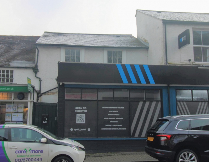
2. C18. Roughcast. Pitched slate roof. 2 storeys. 2 flush-framed cased sashes with glazing bars on 1st floor. Projecting modern shopfront below.
Nos 43 to 57 (odd) form a group.
Listing NGR: TQ2200062442
External links are from the relevant listing authority and, where applicable, Wikidata. Wikidata IDs may be related buildings as well as this specific building. If you want to add or update a link, you will need to do so by editing the Wikidata entry.


Other nearby listed buildings