Latitude: 52.6507 / 52°39'2"N
Longitude: -0.7708 / 0°46'14"W
OS Eastings: 483254
OS Northings: 306592
OS Grid: SK832065
Mapcode National: GBR CRQ.XL7
Mapcode Global: WHFKN.4M7S
Plus Code: 9C4XM62H+7M
Entry Name: Church of All Saints
Listing Date: 14 June 1954
Grade: II*
Source: Historic England
Source ID: 1214996
English Heritage Legacy ID: 400015
Also known as: All Saints' Church, Braunston-in-Rutland
All Saints Church, Braunston-in-Rutland
ID on this website: 101214996
Location: All Saints' Church, Braunston-in-Rutland, Rutland, LE15
County: Rutland
Civil Parish: Braunston-in-Rutland
Built-Up Area: Braunston-in-Rutland
Traditional County: Rutland
Lieutenancy Area (Ceremonial County): Rutland
Church of England Parish: Braunston All Saints
Church of England Diocese: Peterborough
Tagged with: Church building
SK 80 NW BRAUNSTON CEDAR STREET (West side)
1/35 Church of All Saints
14.6.54
GV II*
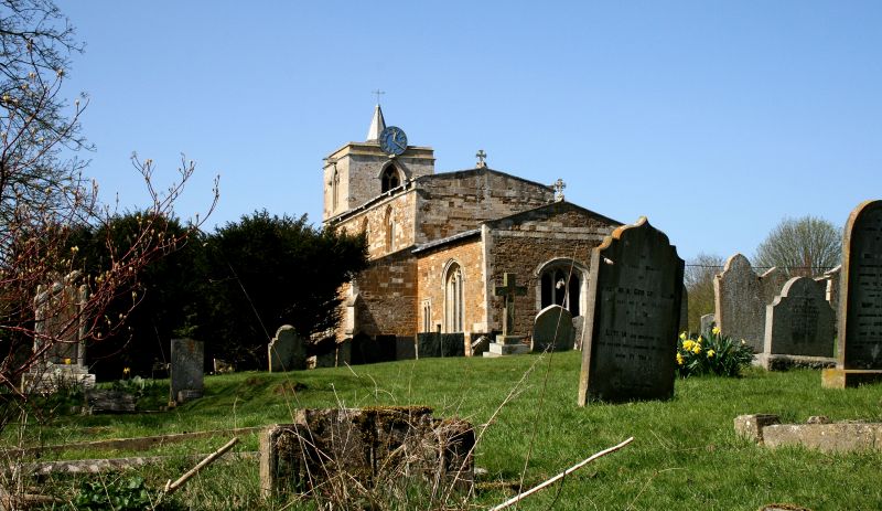
Medieval Parish Church, largely perpendicular externally but with some C12 work within. W. tower, nave with aisles and vestry and chancel W. tower is possibly C14, ashlar and of 3 stages and buttressed. Foiled lights to bell chamber with heavy hoodmould to corbel heads. Small parapet with gargoyles. Incised stone dated 1615. Small west door with window over. Nave, clerestory and chancel are of coursed squared rubble. The square headed windows are a C19 restoration of perpendicular features. A single earlier lancet survives in the chancel. Slight parapet to clerestory. C14 south porch contains the C12 S. door: Slender shafts with foliate capitals support long abaci above which the outer arch has a cross pattern, and there are 2 roll moulded inner arches, but no tympanum. N. aisle appears to be a different build from the rest, and is almost ashlar with blocked door. Victorian vestry to N. of chancel. Inside the nave is of 3 bays, the S-arcade being the earliest, probably early C13. Round piers on high bases with larger round abaci and double chamfered round arched arcade. N. arcade possibly late C14, with octagonal piers and abaci. Perpendicular clerestory and aisle windows: the eastern most of the N. aisle is set in a taller embrasure with stone seating. Nave roof has cambered trusses. Traces of painting in S. aisle. Chancel arch has C12 shafts with wall capitals, the arch itself rather later. Perpendicular chancel windows have early C20 stained glass.
The font is C12 or C13,square with shafts at angles with slightly decorated capitals.
Listing NGR: SK8325406592
External links are from the relevant listing authority and, where applicable, Wikidata. Wikidata IDs may be related buildings as well as this specific building. If you want to add or update a link, you will need to do so by editing the Wikidata entry.


Other nearby listed buildings