Approximate Location Map
Large Map »
Latitude: 53.6764 / 53°40'34"N
Longitude: -1.7909 / 1°47'27"W
OS Eastings: 413908
OS Northings: 420010
OS Grid: SE139200
Mapcode National: GBR HTYX.2V
Mapcode Global: WHC9V.GVDH
Plus Code: 9C5WM6G5+HJ
Entry Name: Lodge to Fixby Park
Listing Date: 29 October 1975
Grade: II
Source: Historic England
Source ID: 1215076
English Heritage Legacy ID: 340131
ID on this website: 101215076
Location: Fixby, Kirklees, West Yorkshire, HD2
County: Kirklees
Electoral Ward/Division: Ashbrow
Parish: Non Civil Parish
Built-Up Area: Huddersfield
Traditional County: Yorkshire
Lieutenancy Area (Ceremonial County): West Yorkshire
Church of England Parish: St Francis Fixby and St Hilda Cowcliffe, Huddersfield
Church of England Diocese: Leeds
Tagged with: Gatehouse
LIGHTRIDGE ROAD
1.
5113
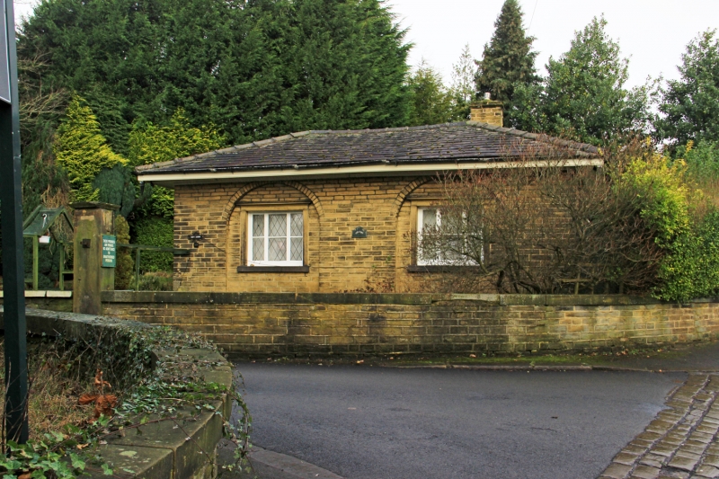
Lodge to Fixby Park
SE 1320 9/804 29.10.75.
II
2.
Early or mid C19. Hammer-dressed stone. Hipped slate roof. One storey.
2 ranges each on south and east sides of tripartite casements, with moulded
cornices in semi-circular relieving arches.
Listing NGR: SE1390820010
External links are from the relevant listing authority and, where applicable, Wikidata. Wikidata IDs may be related buildings as well as this specific building. If you want to add or update a link, you will need to do so by editing the Wikidata entry.


Other nearby listed buildings
