Approximate Location Map
Large Map »
Latitude: 53.5648 / 53°33'53"N
Longitude: -1.8205 / 1°49'13"W
OS Eastings: 411987
OS Northings: 407590
OS Grid: SE119075
Mapcode National: GBR HWQ6.NV
Mapcode Global: WHCBF.0NDJ
Plus Code: 9C5WH57H+WR
Entry Name: Pinfold at Carr Green
Listing Date: 4 August 1983
Grade: II
Source: Historic England
Source ID: 1215590
English Heritage Legacy ID: 340250
ID on this website: 101215590
Location: Flush House, Kirklees, West Yorkshire, HD9
County: Kirklees
Civil Parish: Holme Valley
Traditional County: Yorkshire
Lieutenancy Area (Ceremonial County): West Yorkshire
Church of England Parish: Holmbridge St David
Church of England Diocese: Leeds
Tagged with: Animal pound
SE 10 NW CARR LANE
4/23 (Holmbridge)
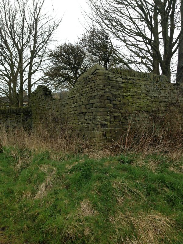
Pinfold at Carr Green
II
Stone pinfold. Probably c18 origin presumably rebuilt. Roughly coursed rubble with
on-edge copings. Rectangular enclosure with single opening, on west side, with stone
lintel. Adjacent and to north is stone trough.
Listing NGR: SE1198707590
External links are from the relevant listing authority and, where applicable, Wikidata. Wikidata IDs may be related buildings as well as this specific building. If you want to add or update a link, you will need to do so by editing the Wikidata entry.


Other nearby listed buildings
