Latitude: 52.9543 / 52°57'15"N
Longitude: -1.4847 / 1°29'4"W
OS Eastings: 434716
OS Northings: 339782
OS Grid: SK347397
Mapcode National: GBR PH2.NB
Mapcode Global: WHDGT.508H
Plus Code: 9C4WXG38+P4
Entry Name: Village Pump
Listing Date: 24 February 1977
Grade: II
Source: Historic England
Source ID: 1216094
English Heritage Legacy ID: 401335
ID on this website: 101216094
Location: Allestree, Derby, Derbyshire, DE22
County: City of Derby
Electoral Ward/Division: Allestree
Parish: Non Civil Parish
Built-Up Area: Derby
Traditional County: Derbyshire
Lieutenancy Area (Ceremonial County): Derbyshire
Church of England Parish: Allestree St Edmund
Church of England Diocese: Derby
Tagged with: Well
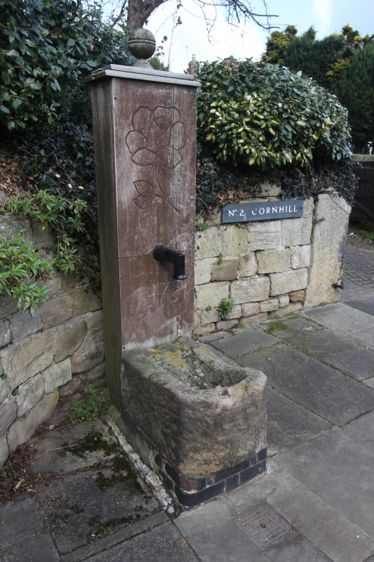
CORNHILL
1.
5170
Allestree
SK 33 NW 7/66 Village Pump
II
2.
Probably early C19. Cast iron pump with basin hollowed out of a sandstone block.
The pump is encased in wood and has a turned wood finial.
Listing NGR: SK3471639782
External links are from the relevant listing authority and, where applicable, Wikidata. Wikidata IDs may be related buildings as well as this specific building. If you want to add or update a link, you will need to do so by editing the Wikidata entry.


Other nearby listed buildings