Approximate Location Map
Large Map »
Latitude: 50.7326 / 50°43'57"N
Longitude: -2.7555 / 2°45'19"W
OS Eastings: 346778
OS Northings: 92825
OS Grid: SY467928
Mapcode National: GBR PP.0CSX
Mapcode Global: FRA 5734.QBG
Plus Code: 9C2VP6MV+2R
Entry Name: 14-22, King Street
Listing Date: 19 September 1975
Grade: II
Source: Historic England
Source ID: 1216278
English Heritage Legacy ID: 401568
ID on this website: 101216278
Location: New Zealand, Dorset, DT6
County: Dorset
Civil Parish: Bridport
Built-Up Area: Bridport
Traditional County: Dorset
Lieutenancy Area (Ceremonial County): Dorset
Church of England Parish: Bridport St Mary
Church of England Diocese: Salisbury
Tagged with: Building
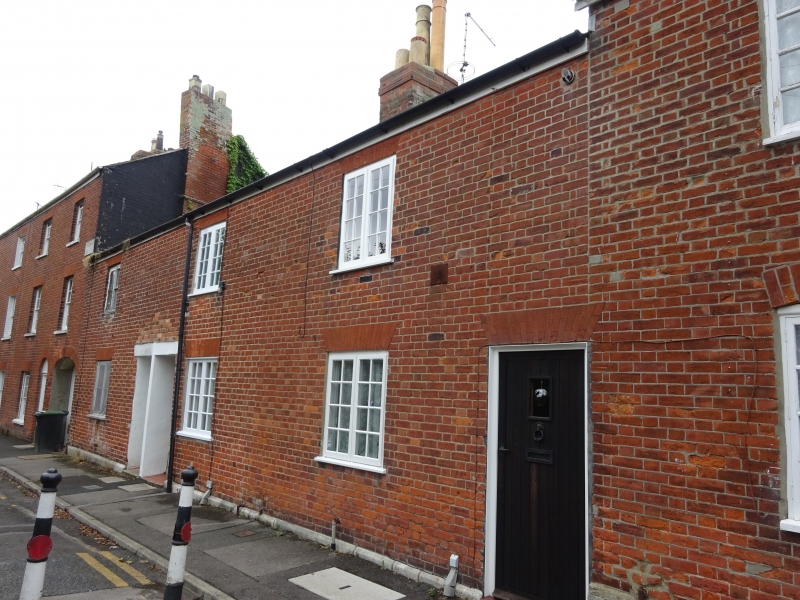
1.
5191 KING STREET
(West Side)
Nos 14 to 22 (even)
SY 4692 1/296
II GV
2.
Late C18 or early Cl9. Red brick. Nos 18, 20 and 22 have gauged brick voussoirs.
Pitched slate roof. Red brick stacks. 2 storeys. 6 ranges of casements with
glazing bars, No 14's and No 16's modern. 1 modern door each.
Nos 6 to 10 (even) and Nos 14 to 44 (even) form a group.
Listing NGR: SY4676992816
External links are from the relevant listing authority and, where applicable, Wikidata. Wikidata IDs may be related buildings as well as this specific building. If you want to add or update a link, you will need to do so by editing the Wikidata entry.


Other nearby listed buildings
