Approximate Location Map
Large Map »
Latitude: 52.1166 / 52°6'59"N
Longitude: -1.3149 / 1°18'53"W
OS Eastings: 447004
OS Northings: 246700
OS Grid: SP470467
Mapcode National: GBR 7S8.BCC
Mapcode Global: VHCW2.5266
Plus Code: 9C4W4M8P+M2
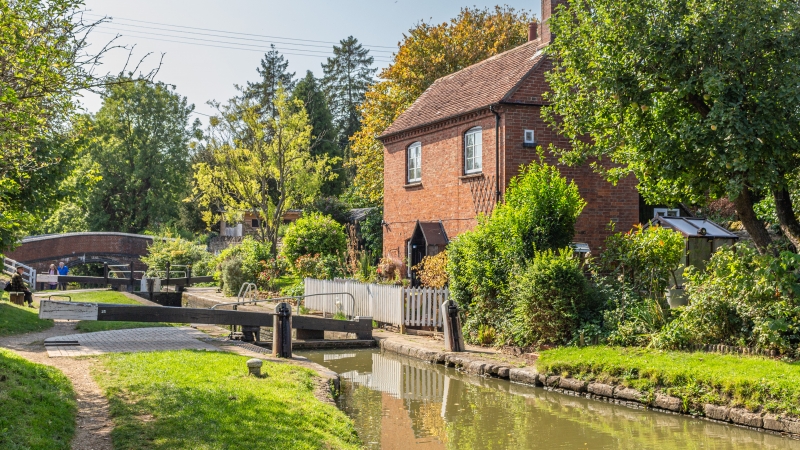
Entry Name: Cropredy Lock Oxford Canal
Listing Date: 26 February 1988
Grade: II
Source: Historic England
Source ID: 1216332
English Heritage Legacy ID: 401504
ID on this website: 101216332
Location: Cropredy, Cherwell, Oxfordshire, OX17
County: Oxfordshire
District: Cherwell
Civil Parish: Cropredy
Built-Up Area: Cropredy
Traditional County: Oxfordshire
Lieutenancy Area (Ceremonial County): Oxfordshire
Church of England Parish: Cropredy
Church of England Diocese: Oxford
Tagged with: Lock
CROPREDY OXFORD CANAL
SP4646
14/66 Cropredy Lock
- II
Lock. Late C18. Brick walls with large stone copings. Wooden gates. The stretch
of Oxford Canal from Coventry to Banbury was completed by 1779.
(VCH; Oxfordshire, Vol X. p161)
Listing NGR: SP4700446700
External links are from the relevant listing authority and, where applicable, Wikidata. Wikidata IDs may be related buildings as well as this specific building. If you want to add or update a link, you will need to do so by editing the Wikidata entry.


Other nearby listed buildings
