Approximate Location Map
Large Map »
Latitude: 52.9249 / 52°55'29"N
Longitude: -1.488 / 1°29'16"W
OS Eastings: 434518
OS Northings: 336512
OS Grid: SK345365
Mapcode National: GBR PGD.XV
Mapcode Global: WHDGT.3RP1
Plus Code: 9C4WWGF6+XR
Entry Name: 58, Friar Gate
Listing Date: 20 June 1952
Grade: II
Source: Historic England
Source ID: 1216469
English Heritage Legacy ID: 401884
ID on this website: 101216469
Location: Derby, Derbyshire, DE1
County: City of Derby
Electoral Ward/Division: Darley
Parish: Non Civil Parish
Built-Up Area: Derby
Traditional County: Derbyshire
Lieutenancy Area (Ceremonial County): Derbyshire
Church of England Parish: Derby St John the Evangelist
Church of England Diocese: Derby
Tagged with: Building
FRIAR GATE
1.
5170
(North Side)
No 58
SK 3436 NE 3/115 20.6.52.
II GV
2.
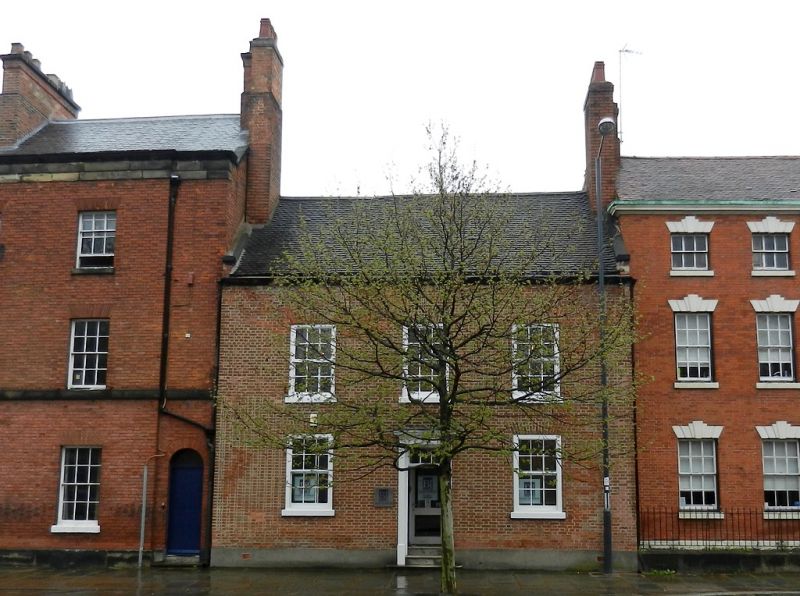
C18 smaller house of 2 storeys. Red brick; 3 sash windows; stone plinth; inset
door in plain wood case; moulded eaves cornice; slates.
Nos 27 to 32 (consec), Friar Gate Railway Bridge, Nos 35 to 39 (consec), Nos 41
to 51 (consec) form a group with No 47 Ford Street.c
Listing NGR: SK3451836512
External links are from the relevant listing authority and, where applicable, Wikidata. Wikidata IDs may be related buildings as well as this specific building. If you want to add or update a link, you will need to do so by editing the Wikidata entry.


Other nearby listed buildings
