Latitude: 53.639 / 53°38'20"N
Longitude: -1.8092 / 1°48'33"W
OS Eastings: 412711
OS Northings: 415849
OS Grid: SE127158
Mapcode National: GBR HVTC.37
Mapcode Global: WHCB1.5SQM
Plus Code: 9C5WJ5QR+J8
Entry Name: Crosland Moor Liberal Club
Listing Date: 12 September 1975
Grade: II
Source: Historic England
Source ID: 1216483
English Heritage Legacy ID: 401902
ID on this website: 101216483
Location: Paddock, Kirklees, West Yorkshire, HD4
County: Kirklees
Electoral Ward/Division: Crosland Moor and Netherton
Parish: Non Civil Parish
Built-Up Area: Huddersfield
Traditional County: Yorkshire
Lieutenancy Area (Ceremonial County): West Yorkshire
Church of England Parish: Crosland Moor St Barnabas
Church of England Diocese: Leeds
Tagged with: Clubhouse
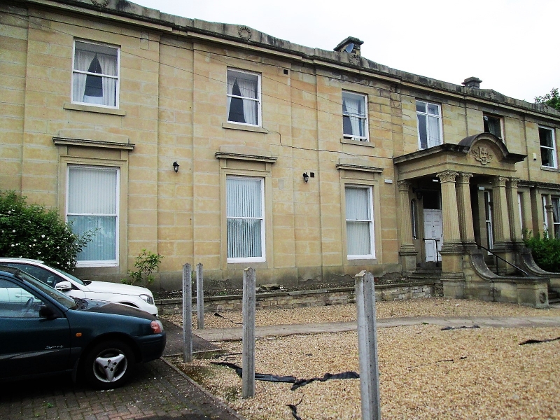
MOORSIDE AVENUE 1. 5113 (North Side) Crosland Moor Crosland Moor Liberal Club SE 1215 38/970 II 2. Mid C19. Ashlar. 2 storeys. Moulded cornice and blocking course, which becomes pediment-shaped over each bay; and is ornamented by sculpted wreath. 6 ranges of sashes, each bay breaking forward slightly; ground floor windows have moulded surrounds and cornice: those at north end tripartite. Elaborate and eclectic porch with 4 fluted columns; full entablature which breaks upward in a semi-circle, and flight of steps with ramped flanking walls and dies with sculpted wreaths.
Listing NGR: SE1271115849
External links are from the relevant listing authority and, where applicable, Wikidata. Wikidata IDs may be related buildings as well as this specific building. If you want to add or update a link, you will need to do so by editing the Wikidata entry.


Other nearby listed buildings