Latitude: 52.4843 / 52°29'3"N
Longitude: -0.9303 / 0°55'49"W
OS Eastings: 472736
OS Northings: 287917
OS Grid: SP727879
Mapcode National: GBR BS9.CLV
Mapcode Global: VHDQS.TTJC
Plus Code: 9C4XF3M9+PV
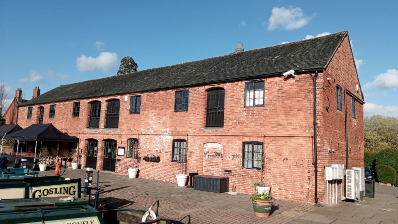
Entry Name: Warehouse East of Union Wharf
Listing Date: 13 November 1975
Grade: II
Source: Historic England
Source ID: 1216544
English Heritage Legacy ID: 189721
ID on this website: 101216544
Location: Market Harborough, Harborough, Leicestershire, LE16
County: Leicestershire
District: Harborough
Electoral Ward/Division: Market Harborough-Logan
Parish: Non Civil Parish
Built-Up Area: Market Harborough
Traditional County: Leicestershire
Lieutenancy Area (Ceremonial County): Leicestershire
Church of England Parish: Market Harborough St Dionysius
Church of England Diocese: Leicester
Tagged with: Warehouse
LEICESTER ROAD 1. 5303 (West Side) (off) Warehouse east of Union Wharf SP 7287 2/90 13.11.75. II
2. Union Wharf completed 1809. Warehouse earlier C19. Situated at the head of canal basin. Red brick. Roof, slates and pantiles, symmetrical design. Eastern facade 2 storeys with paired segmental arched centre doorways ground floor and similar blank pair above. Similar outer doorways on both floors flanked by shuttered window openings. (2 of these between centre and outer ground floor doorways). Rounded jambs to doors. End facade of red brick with some grey headers. 2 louvred windows with segmental arches to top floor.
Listing NGR: SP7273687917
External links are from the relevant listing authority and, where applicable, Wikidata. Wikidata IDs may be related buildings as well as this specific building. If you want to add or update a link, you will need to do so by editing the Wikidata entry.


Other nearby listed buildings