Latitude: 50.8968 / 50°53'48"N
Longitude: -2.2758 / 2°16'32"W
OS Eastings: 380702
OS Northings: 110853
OS Grid: ST807108
Mapcode National: GBR 0XF.MGX
Mapcode Global: FRA 663Q.Z2Q
Plus Code: 9C2VVPWF+PM
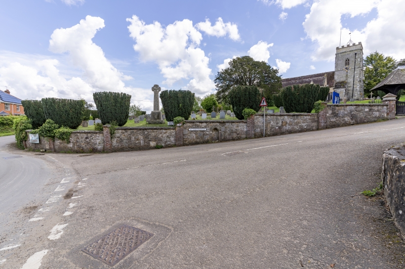
Entry Name: St Andrews Church South Churchyard Wall
Listing Date: 20 December 1983
Grade: II
Source: Historic England
Source ID: 1216649
English Heritage Legacy ID: 402147
ID on this website: 101216649
Location: Okeford Fitzpaine, Dorset, DT11
County: Dorset
Civil Parish: Okeford Fitzpaine
Built-Up Area: Okeford Fitzpaine
Traditional County: Dorset
Lieutenancy Area (Ceremonial County): Dorset
Church of England Parish: Okeford Fitzpaine St Andrew
Church of England Diocese: Salisbury
Tagged with: Architectural structure
ST 8010 OKEFORD FITZPAINE GREENHAYES (EAST SIDE)
15/132 St Andrews church;
south churchyard wall.,
GV II
Churchyard wall cl910-12. Rubble with brick piers. Incorporates fragments
of medieval masonry.
Listing NGR: ST8070210853
External links are from the relevant listing authority and, where applicable, Wikidata. Wikidata IDs may be related buildings as well as this specific building. If you want to add or update a link, you will need to do so by editing the Wikidata entry.


Other nearby listed buildings