Latitude: 53.3464 / 53°20'47"N
Longitude: -0.8179 / 0°49'4"W
OS Eastings: 478793
OS Northings: 383933
OS Grid: SK787839
Mapcode National: GBR QYQR.Q3
Mapcode Global: WHFGB.D4RW
Plus Code: 9C5X85WJ+HR
Entry Name: Church Farm House
Listing Date: 4 December 1985
Grade: II
Source: Historic England
Source ID: 1216695
English Heritage Legacy ID: 411346
ID on this website: 101216695
Location: Sturton le Steeple, Bassetlaw, Nottinghamshire, DN22
County: Nottinghamshire
District: Bassetlaw
Civil Parish: Sturton le Steeple
Built-Up Area: Sturton le Steeple
Traditional County: Nottinghamshire
Lieutenancy Area (Ceremonial County): Nottinghamshire
Church of England Parish: Sturton with Littleborough
Church of England Diocese: Southwell and Nottingham
Tagged with: Farmhouse
SK 78 SE STURTON LE STEEPLE CHURCH STREET (north side)
5/105 Church Farm House
G.V. II
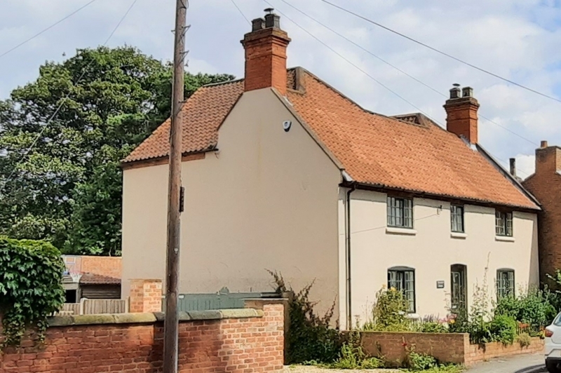
House. Late C18 and c.1909. Brick, rendered and colourwashed, with gabled and hipped pantile roofs. Cogged eaves, 2 coped gables, 2 gable stacks. 2 storeys, 3 bays, L-plan with 2 rear wings. Front has Yorkshire sashes with brick sills. Front has central half glazed door flanked by single windows, all with segmental heads, and above, small central window flanked by single larger windows.
Listing NGR: SK7879383933
External links are from the relevant listing authority and, where applicable, Wikidata. Wikidata IDs may be related buildings as well as this specific building. If you want to add or update a link, you will need to do so by editing the Wikidata entry.


Other nearby listed buildings