Approximate Location Map
Large Map »
Latitude: 51.1829 / 51°10'58"N
Longitude: 0.9368 / 0°56'12"E
OS Eastings: 605348
OS Northings: 146725
OS Grid: TR053467
Mapcode National: GBR SXQ.PPX
Mapcode Global: VHKKH.6J4L
Plus Code: 9F325WMP+4P
Entry Name: 7, Church Street
Listing Date: 16 February 1989
Grade: II
Source: Historic England
Source ID: 1216761
English Heritage Legacy ID: 411424
ID on this website: 101216761
Location: Wye, Ashford, Kent, TN25
County: Kent
District: Ashford
Civil Parish: Wye with Hinxhill
Built-Up Area: Wye
Traditional County: Kent
Lieutenancy Area (Ceremonial County): Kent
Tagged with: Building
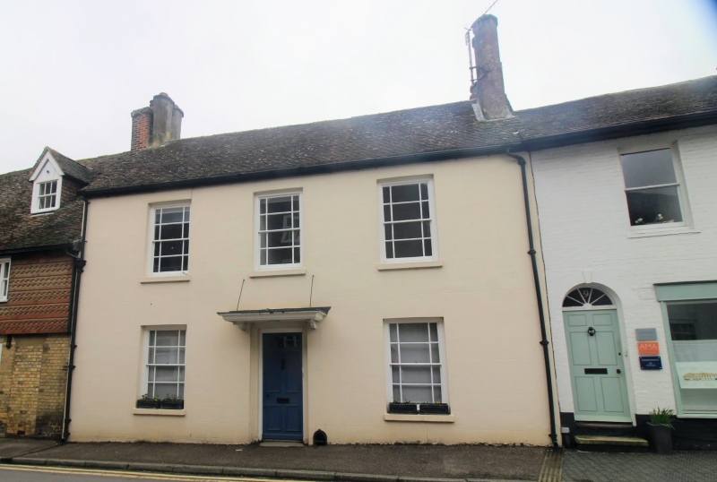
TR 0446 0546 WYE CHURCH STREET
(west side)
No. 7
8/233
GV II
House. Early C19. Faced with channeled render and with plain tiled roof.
Two storeys with stacks to left and with coupled and octagonal shaped flues
to right. Regular fenestration of 3 margin light sashes on 1st floor and
2 on ground floor, with central panelled door with cornice hood on brackets
and with iron ties. Integral foot scraper to right of door.
Listing NGR: TR0534846728
External links are from the relevant listing authority and, where applicable, Wikidata. Wikidata IDs may be related buildings as well as this specific building. If you want to add or update a link, you will need to do so by editing the Wikidata entry.


Other nearby listed buildings
