Approximate Location Map
Large Map »
Latitude: 51.5713 / 51°34'16"N
Longitude: -0.7781 / 0°46'41"W
OS Eastings: 484778
OS Northings: 186535
OS Grid: SU847865
Mapcode National: GBR D5W.G2G
Mapcode Global: VHDWB.GRHS
Plus Code: 9C3XH6CC+GQ
Entry Name: 36, West Street
Listing Date: 31 January 1974
Grade: II
Source: Historic England
Source ID: 1217181
English Heritage Legacy ID: 411984
ID on this website: 101217181
Location: Marlow, Buckinghamshire, SL7
County: Buckinghamshire
Civil Parish: Marlow
Built-Up Area: Marlow
Traditional County: Buckinghamshire
Lieutenancy Area (Ceremonial County): Buckinghamshire
Church of England Parish: Great Marlow with Marlow Bottom, Little Marlow and Bisham
Church of England Diocese: Oxford
Tagged with: Building
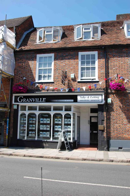
WEST STREET
1.
1385
(North West Side)
No 36
SU 8486 1/148
II GV
2.
Cl8. 2 storeys, red brick, 2 windows. Similar in general proportions to
No 34 (qv above) to which it is linked. Glazing bars. Modern ground
floor shop. Old tile roof.
No 36 and Nos 42 to 50 (even) with Queen Cottage form a group
Listing NGR: SU8477886535
External links are from the relevant listing authority and, where applicable, Wikidata. Wikidata IDs may be related buildings as well as this specific building. If you want to add or update a link, you will need to do so by editing the Wikidata entry.


Other nearby listed buildings
