Latitude: 50.8131 / 50°48'47"N
Longitude: -0.4996 / 0°29'58"W
OS Eastings: 505803
OS Northings: 102576
OS Grid: TQ058025
Mapcode National: GBR GL0.SN9
Mapcode Global: FRA 96VY.76H
Plus Code: 9C2XRG72+65
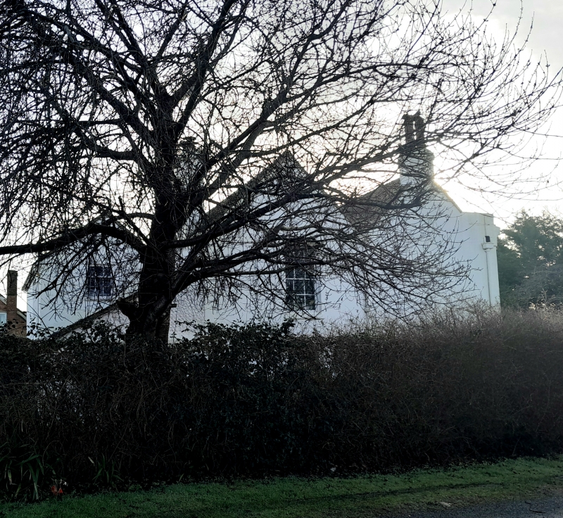
Entry Name: Herne Farm House
Listing Date: 16 August 1984
Grade: II
Source: Historic England
Source ID: 1217221
English Heritage Legacy ID: 298034
ID on this website: 101217221
Location: Rustington, Arun, West Sussex, BN16
County: West Sussex
District: Arun
Civil Parish: Rustington
Built-Up Area: Littlehampton
Traditional County: Sussex
Lieutenancy Area (Ceremonial County): West Sussex
Church of England Parish: Rushington
Church of England Diocese: Chichester
Tagged with: Farmhouse
TQ 0502 RUSTINGTON PARK DRIVE
26/165
16.8.84 Herne Farm House
II
Early C19. Two parallel ranges. Two storeys. Three windows. Stuccoed.
Stringcourse, cornice and parapet. Tiled roof. Casement windows. Glazing bars
intact.
Listing NGR: TQ0580302576
External links are from the relevant listing authority and, where applicable, Wikidata. Wikidata IDs may be related buildings as well as this specific building. If you want to add or update a link, you will need to do so by editing the Wikidata entry.


Other nearby listed buildings