Latitude: 50.4926 / 50°29'33"N
Longitude: -3.7789 / 3°46'44"W
OS Eastings: 273911
OS Northings: 67376
OS Grid: SX739673
Mapcode National: GBR QG.XDXL
Mapcode Global: FRA 27ZR.FMD
Plus Code: 9C2RF6VC+2C
Entry Name: Higher Mill, Including Walls to Leat at North End and Remains of Machinery
Listing Date: 6 January 1983
Last Amended: 30 December 1993
Grade: II
Source: Historic England
Source ID: 1218037
English Heritage Legacy ID: 392295
ID on this website: 101218037
Location: Buckfast, Teignbridge, Devon, TQ11
County: Devon
District: Teignbridge
Civil Parish: Buckfastleigh
Built-Up Area: Buckfast
Traditional County: Devon
Lieutenancy Area (Ceremonial County): Devon
Church of England Parish: Buckfastleigh
Church of England Diocese: Exeter
Tagged with: Mill building
BUCKFASTLEIGH
SX76NW HIGHER MILL LANE, Buckfast 1011-1/1/40 (East side) 06/01/83 Higher Mill, including walls to leat at north end and remains of machinery (Formerly Listed as: HIGHER MILL LANE, Buckfast Higher Mill, premises of Buckfast Plating Co Ltd)
GV II
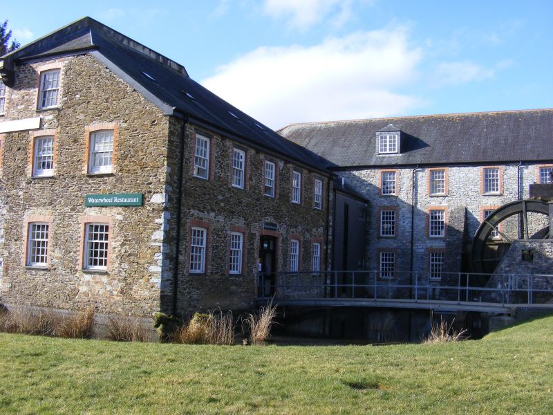
Woollen mill, later used as plating factory, disused at time of survey (1992). Mill probably late C18 with later alterations. Local grey limestone rubble, upper storeys of front elevation slate-hung, half basement partly rendered. Asbestos slate roof, half hipped at right end, gabled at left end; left end stack with rendered shaft. Plan: large rectangular building fronting the road with a cartway entrance at the left end. The mill consists of large open rooms on each floor including an attic floor, the first and 2nd floors are well lit with large front and rear windows. Staircase to rear of cartway entrance. Machinery was presumably powered by the leat at the west end, which runs underground, emerging near the south gate of Buckfast Abbey, to the SE. A (truncated) launder (qv) to rear of the mill, carries a second water supply parallel to the mill with a sluice between the mill and the rear range. EXTERIOR: 3 storeys, the ground floor storey slightly below road level at the front. Asymmetrical 7-window range. Roof line rises at left end to left of a gabled dormer which may have been associated with a hoist. Cartway to left with paired plank doors. Ground-floor windows glazed with various C20 casements. First-floor windows probably most with the original sash frames in original embrasures but mostly reglazed. 7 second-floor 20-pane hornless sash windows, probably late C18, some in poor state of repair. 3 hipped roof attic dormers light the roofspace. The left return has a loft loading door. The right return, overlooking the leat, has 3 round-headed recesses in the centre, one to each storey, thelower opening partly glazed. Boarded rectangular windows in the outer bays, ground and first floor, the ground-floor right opening glazed. The rear elevation is buttressed, most of the windows boarded up at time of survey. INTERIOR: ground floor has chamfered crossbeams with runout stops and exposed joists. An axial row of cast-iron columns supports the crossbeams. The columns divide into 2 at the top. The first floor has chamfered cross beams and a row of secondary axial posts. The 2nd floor has chamfered cross beams with metal shoes at either end to which loose metal rods are attached. Attic storey floored. Roof: Probably C18 roof construction of large scantling, mortised at the apex with a mortised collar and queen posts which have iron straps tied over the principals; probably secondary high butt collar. Historical note: the documentation for this building has been researched by Elizabeth Knowling. There was a mill on the site by at least 1730, described as a tucking mill by 1760. In 1800 "Mills" were described as "lately erected on the site previously occupied by the tucking mill". By 1953 the buildings were in use as a plating works. The late C18/early C19 owner, Samuel Berry, built himself a house at Buckfast Abbey (qv) out of reused material. Physical remains of the wool industry, crucial to the economy of Devon in the C16, C17 and C18, are rare in the county. This building is certainly one of the earliest and most intact in the county and a significant surviving example. (Knowling E: Private archive: 1991-).
Listing NGR: SX7391167376
External links are from the relevant listing authority and, where applicable, Wikidata. Wikidata IDs may be related buildings as well as this specific building. If you want to add or update a link, you will need to do so by editing the Wikidata entry.


Other nearby listed buildings