Latitude: 51.2952 / 51°17'42"N
Longitude: 0.4088 / 0°24'31"E
OS Eastings: 568042
OS Northings: 157869
OS Grid: TQ680578
Mapcode National: GBR NPC.N6C
Mapcode Global: VHJM5.1QH0
Plus Code: 9F327CW5+3G
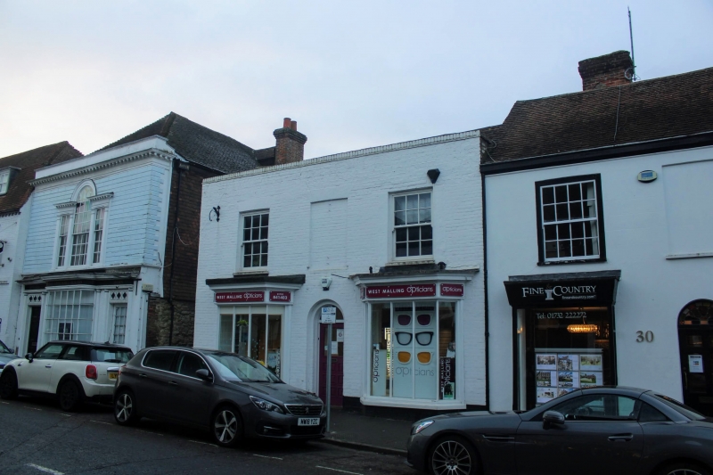
Entry Name: 32, High Street
Listing Date: 30 November 1993
Grade: II
Source: Historic England
Source ID: 1218055
English Heritage Legacy ID: 392335
ID on this website: 101218055
Location: West Malling, Tonbridge and Malling, Kent, ME19
County: Kent
District: Tonbridge and Malling
Civil Parish: West Malling
Built-Up Area: West Malling
Traditional County: Kent
Lieutenancy Area (Ceremonial County): Kent
Church of England Parish: West Malling St Mary
Church of England Diocese: Rochester
Tagged with: Building
WEST MALLING
TQ6857 HIGH STREET
1156-0/3/40 (West side)
No.32
GV II
Shop. Early C19. Painted brick with old tiled roof. 2 storeys
3 window spaces. Parapet. End windows altered 2. C19 3-light
canted bays to ground floor and central round-headed doorcase
with C20 doors. Included for group value.
Listing NGR: TQ6803557871
External links are from the relevant listing authority and, where applicable, Wikidata. Wikidata IDs may be related buildings as well as this specific building. If you want to add or update a link, you will need to do so by editing the Wikidata entry.


Other nearby listed buildings