Latitude: 53.5154 / 53°30'55"N
Longitude: -2.1012 / 2°6'4"W
OS Eastings: 393389
OS Northings: 402084
OS Grid: SD933020
Mapcode National: GBR FWRS.XK
Mapcode Global: WHB9B.PWNX
Plus Code: 9C5VGV8X+5G
Entry Name: Bank Top Farmhouse
Listing Date: 23 January 1973
Last Amended: 8 March 1993
Grade: II
Source: Historic England
Source ID: 1218248
English Heritage Legacy ID: 388935
ID on this website: 101218248
Location: Bardsley, Oldham, Greater Manchester, OL8
County: Oldham
Electoral Ward/Division: Medlock Vale
Parish: Non Civil Parish
Traditional County: Lancashire
Lieutenancy Area (Ceremonial County): Greater Manchester
Church of England Parish: Bardsley Holy Trinity
Church of England Diocese: Manchester
Tagged with: Farmhouse
OLDHAM
SD90SW SELBOURNE STREET 780-1/3/74 (North side) 23/01/73 Bank Top Farmhouse (Formerly Listed as: ASHTON ROAD Bank Top Farmhouse)
II
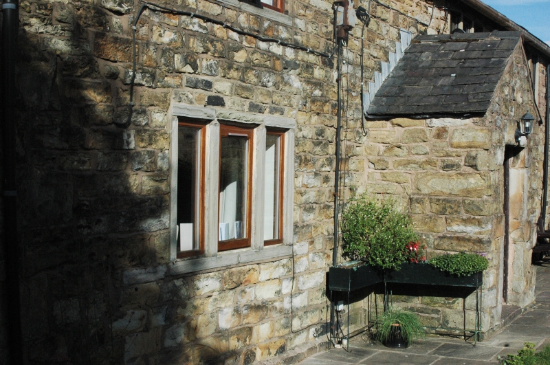
Farmhouse. Early C18. Roughly coursed and squared stone, with stone flagged roof. Low 2 storeys, 3-window range. 3-room baffle-entry plan with central entrance in gabled porch, with additional doorway to right. Windows all renewed, possibly in original openings. End wall stacks. Central room has fireplace with plain stone surround. Chamfered ceiling beams rest on bressumer, and to right hand, on re-used jowelled posts, cut down. Roof timbers mostly retained.
Listing NGR: SD9338902084
External links are from the relevant listing authority and, where applicable, Wikidata. Wikidata IDs may be related buildings as well as this specific building. If you want to add or update a link, you will need to do so by editing the Wikidata entry.


Other nearby listed buildings