Latitude: 54.1559 / 54°9'21"N
Longitude: -3.1859 / 3°11'9"W
OS Eastings: 322652
OS Northings: 473987
OS Grid: SD226739
Mapcode National: GBR 6N6D.10
Mapcode Global: WH72B.1S5X
Plus Code: 9C6R5R47+8J
Entry Name: 16, Market Place
Listing Date: 6 May 1976
Last Amended: 20 December 1993
Grade: II
Source: Historic England
Source ID: 1218335
English Heritage Legacy ID: 388506
ID on this website: 101218335
Location: Dalton-in-Furness, Westmorland and Furness, Cumbria, LA15
County: Westmorland and Furness
District: Barrow-in-Furness
Civil Parish: Dalton Town with Newton
Built-Up Area: Dalton-in-Furness
Traditional County: Lancashire
Lieutenancy Area (Ceremonial County): Cumbria
Church of England Parish: Dalton-in-Furness St Mary
Church of England Diocese: Carlisle
Tagged with: Building
BARROW IN FURNESS
SD2273 MARKET PLACE, Dalton In Furness 708-1/11/177 (North side) 06/05/76 No.16 (Formerly Listed as: MARKET PLACE, Dalton Nos.13-17 (Consecutive))
GV II
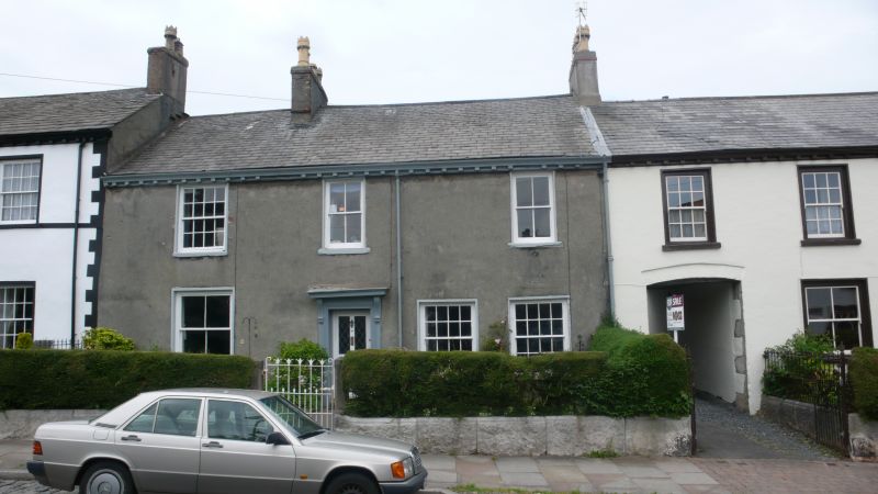
House. Late C18, altered. Ruled stucco over stone, graduated slate roof. 2 storeys, 3 windows to 1st floor. Central dorway has part-glazed door in wooden architrave beneath cornice on consoles. Two 16-pane sashes on right and a 4-pane sash to left; projecting stone sills and thin surrounds. 1st floor: one 16-pane sash and 2, narrower 4-pane sashes similarly treated. Ogee cast-iron gutter on blocks. Ridge stack between bays 1 and 2; party-wall end stack on right.
Listing NGR: SD2265273987
External links are from the relevant listing authority and, where applicable, Wikidata. Wikidata IDs may be related buildings as well as this specific building. If you want to add or update a link, you will need to do so by editing the Wikidata entry.


Other nearby listed buildings