Latitude: 49.9152 / 49°54'54"N
Longitude: -6.311 / 6°18'39"W
OS Eastings: 90638
OS Northings: 10573
OS Grid: SV906105
Mapcode National: GBR BXTX.038
Mapcode Global: VGYC4.KDHD
Plus Code: 8CXMWM8Q+3J
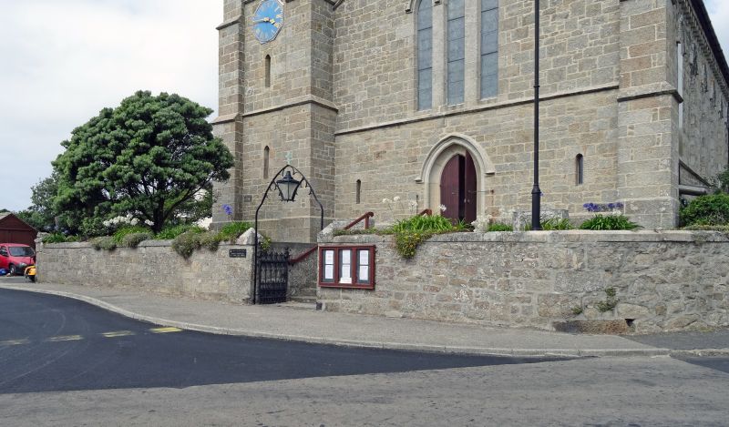
Entry Name: Wall and Gateway to West of Church of St Mary's
Listing Date: 14 December 1992
Grade: II
Source: Historic England
Source ID: 1218646
English Heritage Legacy ID: 62484
ID on this website: 101218646
Location: St Mary's Parish Church, Hugh Town, Isles of Scilly, Cornwall, TR21
County: Isles of Scilly
Civil Parish: St. Mary's
Built-Up Area: Hugh town
Lieutenancy Area (Ceremonial County): Cornwall
Church of England Parish: Isles of Scilly
Church of England Diocese: Truro
Tagged with: Wall
ST. MARY'S
SV9010 CHURCH ROAD, Hugh Town 1358-0/8/44 (West side) Wall and gateway to W. of Church of St. Mary's
GV II
Wall and gateway. 1836-8. Coursed and dressed granite wall with flat coping. Wrought-iron gates to front of steps, surmounted by wrought-iron overthrow with trefoils flanking lantern. Included for group value.
Listing NGR: SV9064010575
External links are from the relevant listing authority and, where applicable, Wikidata. Wikidata IDs may be related buildings as well as this specific building. If you want to add or update a link, you will need to do so by editing the Wikidata entry.


Other nearby listed buildings