Latitude: 51.4941 / 51°29'38"N
Longitude: -0.1505 / 0°9'1"W
OS Eastings: 528493
OS Northings: 178858
OS Grid: TQ284788
Mapcode National: GBR BL.DL
Mapcode Global: VHGQZ.BQT0
Plus Code: 9C3XFRVX+JR
Entry Name: 42-45, CHESTER SQUARE SW1 (See details for further address information)
Listing Date: 9 January 1970
Grade: II
Source: Historic England
Source ID: 1219286
English Heritage Legacy ID: 209162
ID on this website: 101219286
Location: Belgravia, Westminster, London, SW1W
County: London
District: City of Westminster
Electoral Ward/Division: Knightsbridge and Belgravia
Parish: Non Civil Parish
Built-Up Area: City of Westminster
Traditional County: Middlesex
Lieutenancy Area (Ceremonial County): Greater London
Church of England Parish: St Michael Chester Square
Church of England Diocese: London
Tagged with: Building
TQ 2878 NW CITY OF WESTMINSTER CHESTER SQUARE, SW1 102/32 (south side)
Nos 42 to 45 (consec) 9.1.70 including 45a & 45b
GV II
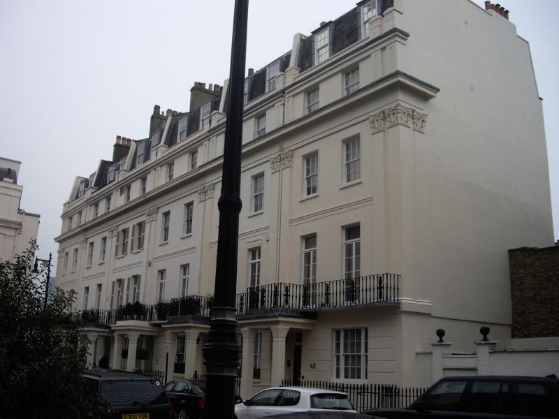
Row of houses. Early to mid C19. Stucco. Slate mansards. 3 storeys with attic mansard, to Nos 42 and 45a and full attic to rest, Nos 43, 45 and 45b with additional attic mansard. Houses divided by giant paired pilasters with curious free "Ionic" capitals. Channelling to ground floor. Projecting porches with square piers and cushion capitals. Continuous cast iron balcony to first floor. Square headed windows, sashes, mostly retaining glazing bars; French casements to first floor. Dentil cornice above second floor. Attic with incised pilasters between houses. Cast iron area railings.
Listing NGR: TQ2849378858
External links are from the relevant listing authority and, where applicable, Wikidata. Wikidata IDs may be related buildings as well as this specific building. If you want to add or update a link, you will need to do so by editing the Wikidata entry.


Other nearby listed buildings