Latitude: 53.7478 / 53°44'51"N
Longitude: -3.0324 / 3°1'56"W
OS Eastings: 332016
OS Northings: 428427
OS Grid: SD320284
Mapcode National: GBR 7T83.98
Mapcode Global: WH85N.D276
Plus Code: 9C5RPXX9+43
Entry Name: Promenade Shelter Opposite West End of Open Air Baths
Listing Date: 15 February 1993
Grade: II
Source: Historic England
Source ID: 1219362
English Heritage Legacy ID: 385316
ID on this website: 101219362
Location: Lytham St Anne's, Fylde, Lancashire, FY8
County: Lancashire
District: Fylde
Civil Parish: Saint Anne's on the Sea
Built-Up Area: Lytham St Anne's
Traditional County: Lancashire
Lieutenancy Area (Ceremonial County): Lancashire
Church of England Parish: St Annes on Sea St Anne (Heyhouses)
Church of England Diocese: Blackburn
LYTHAM ST ANNES
SD32NW SOUTH PROMENADE, St Annes 621-1/2/113 (South West side) Promenade shelter opposite W end of open air baths
GV II
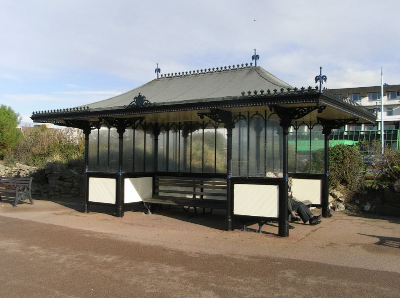
Promenade shelter. Probably c.1890-1914. Cast-iron, wood and glass, with felted roof. Rectangular plan with benches back-to-back on the long axis and at both ends also, all partitioned by wooden and glazed screens; sets of cast-iron columns (5 at each end) forming the frame to the partitions, with long cast-iron open-work brackets to a wide oversailing roof, which is hipped and strongly swept, and has ornamental cresting to the eaves and ridge, and corner finials. One of a matching pair approx. 50 metres apart.
Listing NGR: SD3201628427
External links are from the relevant listing authority and, where applicable, Wikidata. Wikidata IDs may be related buildings as well as this specific building. If you want to add or update a link, you will need to do so by editing the Wikidata entry.


Other nearby listed buildings