Latitude: 54.1424 / 54°8'32"N
Longitude: -0.7793 / 0°46'45"W
OS Eastings: 479839
OS Northings: 472528
OS Grid: SE798725
Mapcode National: GBR RN0J.2T
Mapcode Global: WHFBH.045P
Plus Code: 9C6X46RC+X7
Entry Name: Walls Bounding Churchyard of St Mary's Priory Church
Listing Date: 29 September 1951
Last Amended: 5 April 1993
Grade: I
Source: Historic England
Source ID: 1220206
English Heritage Legacy ID: 389557
ID on this website: 101220206
Location: St Mary's Priory Church, Old Malton, North Yorkshire, YO17
County: North Yorkshire
District: Ryedale
Civil Parish: Malton
Built-Up Area: Malton
Traditional County: Yorkshire
Lieutenancy Area (Ceremonial County): North Yorkshire
Church of England Parish: Old Malton St Mary the Virgin
Church of England Diocese: York
Tagged with: Wall
MALTON
SE7872 TOWN STREET, Old Malton 801-1/6/237 (South East side) 29/09/51 Walls bounding churchyard of St Mary's Priory Church (Formerly Listed as: TOWN STREET, Old Malton (South East side) Church of St Mary the Virgin and boundary walls)
GV I
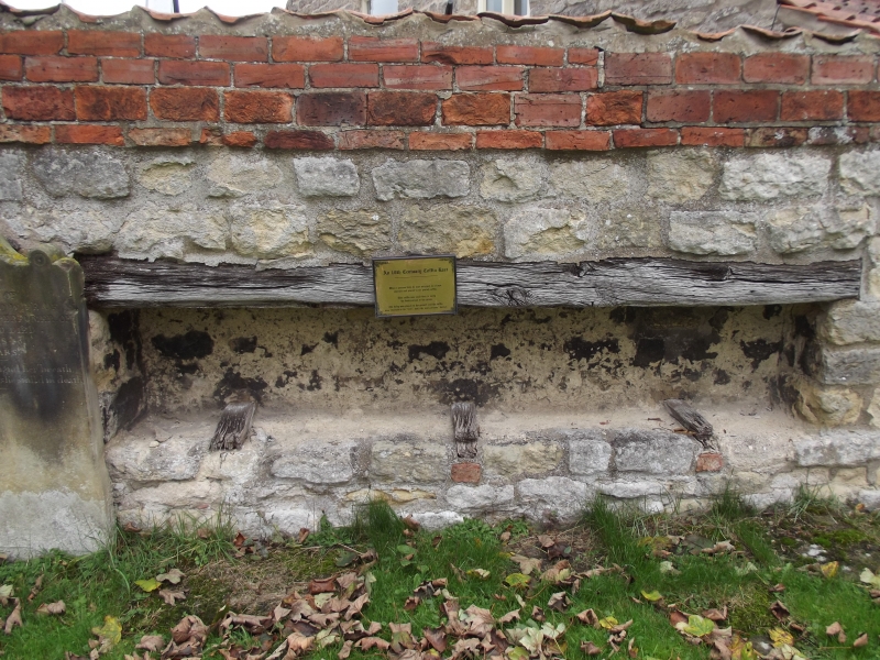
Walls, railings, gate piers and gates to churchyard of St Mary's Priory Church. Largely mid C18, part early C19, incorporating C12 remains of original priory church. Walls of coursed squared stone, with sections of rubble stone and of brick; Priory remains of ashlar. Copings of stone and pantiles; cast-iron gates and railings. Entrance gates and screen walls on north side: double gates of fluted rails with spearhead finials, and middle and bottom bands pierced with quatrefoils. Square on plan piers, approx 2m high, on moulded bases, with panelled sides of Gothick tracery, overhanging cornices and shaped caps. Flanking screen walls, approx 1m high and serpentine on plan, with flat coping, surmounted by railings similar to gate rails. Wall to west: approx 1.75m high, with flat coping; gables at intervals to house inset headstones. Wall to south: varying in height, with sloped pantile coping. Section to west incorporates 4 inset gabled headstones. Further east, original connecting doorway from south aisle of church into cloister survives, now closed by similar double gates to those in churchyard entrance. Round arch of 2 roll-moulded orders, beneath moulded hood; shafts largely decayed, though one waterleaf capital survives. Much defaced piscina to east. Wall to east: incorporates remains of crossing tower piers of priory church. Abutting north-east angle of present church is reset doorway, possibly from the priory chapter-house: round arch of 2 orders, the inner roll-moulded, the outer enriched with beakhead, on shafts with scalloped capitals. To south, defaced cartouche with winged cherub head. Wall to north, adjoining Holgate's House (qv): parish coffin shelf beneath long timber lintel. The churchyard is on the site of the Gilbertine Priory of St Mary, scheduled as an Ancient Monument, County No.383.
Listing NGR: SE7978872535
External links are from the relevant listing authority and, where applicable, Wikidata. Wikidata IDs may be related buildings as well as this specific building. If you want to add or update a link, you will need to do so by editing the Wikidata entry.


Other nearby listed buildings