Approximate Location Map
Large Map »
Latitude: 51.4867 / 51°29'12"N
Longitude: -2.7694 / 2°46'9"W
OS Eastings: 346671
OS Northings: 176696
OS Grid: ST466766
Mapcode National: GBR JH.KG37
Mapcode Global: VH7BW.YW8P
Plus Code: 9C3VF6PJ+M6
Entry Name: 1, Woodhill Road
Listing Date: 4 August 1981
Grade: II
Source: Historic England
Source ID: 1220400
English Heritage Legacy ID: 394096
ID on this website: 101220400
Location: Portishead, North Somerset, BS20
County: North Somerset
Civil Parish: Portishead
Built-Up Area: Portishead
Traditional County: Somerset
Lieutenancy Area (Ceremonial County): Somerset
Tagged with: Building
1.
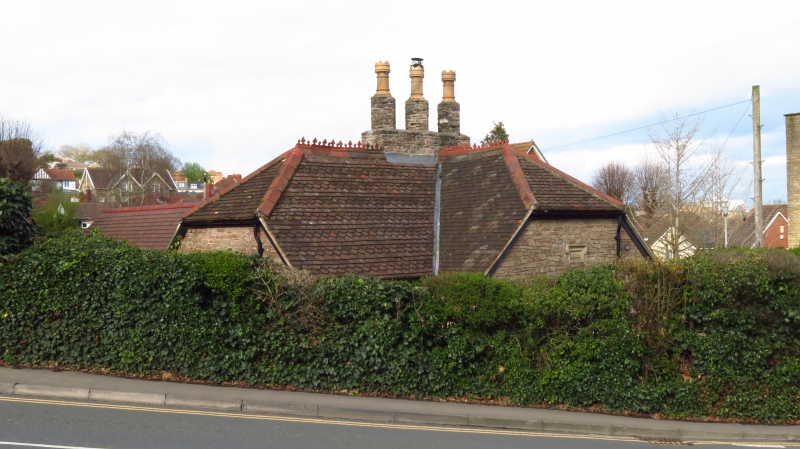
5121 WOODHILL ROAD
(west side)
No 1
ST 4676 3/26
II
2.
Dated 1828. Former toll house or lodge. Coursed rubble, decorative tiled
roof. Two light casement windows with drip moulds. Open porch.
Listing NGR: ST4667176696
External links are from the relevant listing authority and, where applicable, Wikidata. Wikidata IDs may be related buildings as well as this specific building. If you want to add or update a link, you will need to do so by editing the Wikidata entry.


Other nearby listed buildings
