Latitude: 51.4327 / 51°25'57"N
Longitude: -2.3966 / 2°23'47"W
OS Eastings: 372526
OS Northings: 170486
OS Grid: ST725704
Mapcode National: GBR JZ.NZVZ
Mapcode Global: VH96D.D8W0
Plus Code: 9C3VCJM3+39
Entry Name: Archway About 64 Metres East of Battlefields House
Listing Date: 15 August 1985
Grade: II
Source: Historic England
Source ID: 1220624
English Heritage Legacy ID: 394210
ID on this website: 101220624
Location: Lower Hamswell, South Gloucestershire, BA1
County: South Gloucestershire
Civil Parish: Cold Ashton
Traditional County: Gloucestershire
Lieutenancy Area (Ceremonial County): Gloucestershire
Church of England Parish: Marshfield with Cold Ashton and Tormarton
Church of England Diocese: Bristol
Tagged with: Archway
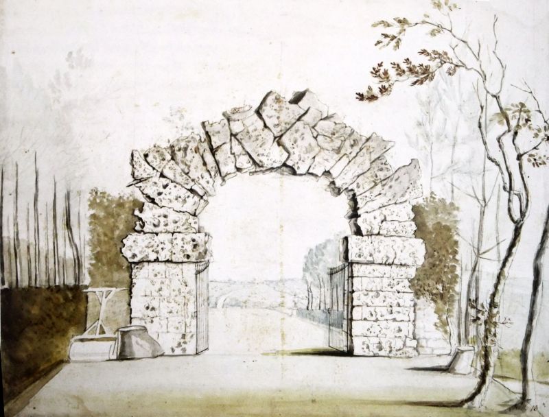
ST 77 SW COLD ASHTON C.P. BATH ROAD (east side)
8/3 Archway about 64 metres east of
Battlefields House
G.V.
II
Archway. Early C19. Limestone, rusticated in imitation of volcanic stone. Piers
of square plan with large impost blocks supporting round-headed arch with keystone.
Listing NGR: ST7252670486
External links are from the relevant listing authority and, where applicable, Wikidata. Wikidata IDs may be related buildings as well as this specific building. If you want to add or update a link, you will need to do so by editing the Wikidata entry.


Other nearby listed buildings