Latitude: 50.6795 / 50°40'46"N
Longitude: -1.2159 / 1°12'57"W
OS Eastings: 455492
OS Northings: 86944
OS Grid: SZ554869
Mapcode National: GBR 9D4.CDQ
Mapcode Global: FRA 87B8.XSY
Plus Code: 9C2WMQHM+RJ
Entry Name: Mersley Farmhouse
Listing Date: 14 February 1992
Grade: II
Source: Historic England
Source ID: 1221166
English Heritage Legacy ID: 310194
ID on this website: 101221166
Location: Isle of Wight, PO36
County: Isle of Wight
Civil Parish: Newchurch
Traditional County: Hampshire
Lieutenancy Area (Ceremonial County): Isle of Wight
Church of England Parish: Newchurch All Saints
Church of England Diocese: Portsmouth
Tagged with: Farmhouse
NEWCHURCH SZ58NE THE SHUTE 1352-0/1/162 Mersley Farmhouse II
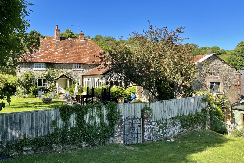
Farmhouse. Front C16 or C17 altered in early C18, L wing C18. Built of Isle of Wight stone rubble with ashlar quoins. Steeply pitched tiled roof with 2 brick stacks. 2 storeys 2 windows. 2 triple renewed casements to 1st floor in original stone architraves. 2 larger triple casements to ground floor in original architraves. Later gabled porch and early C19 6-flush panelled door. C18 L wing is of painted brick. 1 storey and attic, with end brick chimney stack. Late C17 or early C18 mullioned window, 1 gabled dormer and later passageway. Original portion contains remains of timber framing, very thick beams, probably C16 judging by the scantling and lack of chamfers.
Listing NGR: SZ5549286944
External links are from the relevant listing authority and, where applicable, Wikidata. Wikidata IDs may be related buildings as well as this specific building. If you want to add or update a link, you will need to do so by editing the Wikidata entry.


Other nearby listed buildings