Approximate Location Map
Large Map »
Latitude: 50.9858 / 50°59'8"N
Longitude: 0.4765 / 0°28'35"E
OS Eastings: 573916
OS Northings: 123633
OS Grid: TQ739236
Mapcode National: GBR PVN.19F
Mapcode Global: FRA C6WH.X07
Plus Code: 9F22XFPG+8H
Entry Name: Hill House
Listing Date: 13 May 1987
Grade: II
Source: Historic England
Source ID: 1221270
English Heritage Legacy ID: 412920
ID on this website: 101221270
Location: Robertsbridge, Rother, East Sussex, TN32
County: East Sussex
District: Rother
Civil Parish: Salehurst and Robertsbridge
Built-Up Area: Robertsbridge
Traditional County: Sussex
Lieutenancy Area (Ceremonial County): East Sussex
Church of England Parish: Salehurst St Mary
Church of England Diocese: Chichester
Tagged with: House
TQ 7223-7323
42/6
SALEHURST
FAIR LANE, Robertsbridge
(north side)
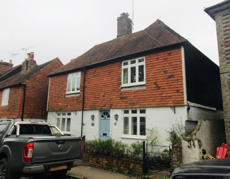
No 21 (Hill House)
GV
II
Early C19. 2 storeys. 2 windows. Ground floor painted brick above tile-hung.
Tiled roof. Casement windows.
Listing NGR: TQ7391623633
External links are from the relevant listing authority and, where applicable, Wikidata. Wikidata IDs may be related buildings as well as this specific building. If you want to add or update a link, you will need to do so by editing the Wikidata entry.


Other nearby listed buildings
