Latitude: 51.191 / 51°11'27"N
Longitude: 0.8476 / 0°50'51"E
OS Eastings: 599076
OS Northings: 147387
OS Grid: TQ990473
Mapcode National: GBR RW8.C2L
Mapcode Global: VHKKF.MBY9
Plus Code: 9F325RRX+C2
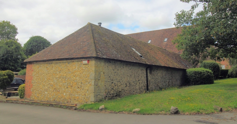
Entry Name: Outbuilding at Court Lodge Farm with North and East Facing Flint Walls
Listing Date: 16 September 1985
Grade: II
Source: Historic England
Source ID: 1221345
English Heritage Legacy ID: 181345
ID on this website: 101221345
Location: Westwell, Ashford, Kent, TN25
County: Kent
District: Ashford
Civil Parish: Westwell
Traditional County: Kent
Lieutenancy Area (Ceremonial County): Kent
Tagged with: Appendage
1. 5272 WESTWELL EASTWELL LANE Outbuilding at Court Lodge Farm with north and east facing flint walls TQ 94 NE SP/19 II GV 2. Fragment of a medieval building connected with Court Lodge Farm. Medieval origin. Section of north facing flint walling with stone quoins at each end, returning south at the east end.Incorporated into a later outbuilding, of C18 or earlier C19, which is shown on Tithe Plan of;1840, but which has been subsequently altered in C20. This outbuilding has plain tile hipped roof and brick walls, the brick renewed in C20 at east end of south elevation. In the rest of the south elevation the rear pitch of the roof and the wall of this outbuilding have been demolished in the C20, on extension of the outbuilding, being replaced by a roof of shallower pitch and walls of concrete blocks. Included on account of section of north and east facing flint walling with stone quoins.
Listing NGR: TQ9907647386
External links are from the relevant listing authority and, where applicable, Wikidata. Wikidata IDs may be related buildings as well as this specific building. If you want to add or update a link, you will need to do so by editing the Wikidata entry.


Other nearby listed buildings