Latitude: 51.5014 / 51°30'5"N
Longitude: -0.1651 / 0°9'54"W
OS Eastings: 527457
OS Northings: 179652
OS Grid: TQ274796
Mapcode National: GBR 7H.3Y
Mapcode Global: VHGQZ.3J2C
Plus Code: 9C3XGR2M+HX
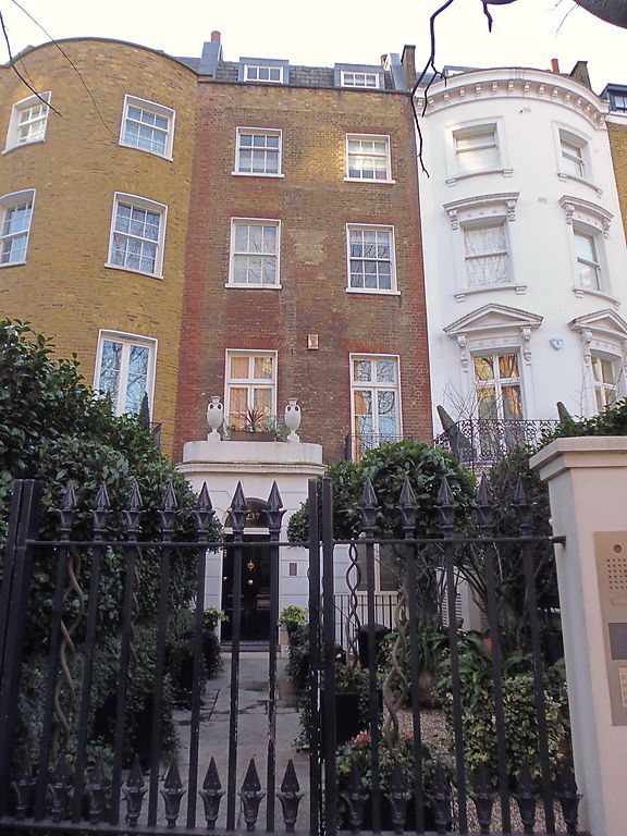
Entry Name: 237, Knightsbridge SW7
Listing Date: 9 May 1985
Grade: II
Source: Historic England
Source ID: 1221562
English Heritage Legacy ID: 413401
ID on this website: 101221562
Location: Knightsbridge, Westminster, London, SW7
County: London
District: City of Westminster
Electoral Ward/Division: Knightsbridge and Belgravia
Parish: Non Civil Parish
Built-Up Area: City of Westminster
Traditional County: Middlesex
Lieutenancy Area (Ceremonial County): Greater London
Church of England Parish: Holy Trinity South Kensington
Church of England Diocese: London
Tagged with: Building
TQ 2779 NW CITY OF WESTMINSTER KNIGHTSBRIDGE, SW7 86/53 9.5.85 No 237 GV II Terraced house. Early C19. Brick, stucco. Roof not visible. 4 storeys and basement, 2 windows wide. Channelling to ground floor with projecting round cornered solid sided porch to left; round headed entrance panelled door; cornice and parapet. Ground floor right hand window in round headed reveal. Square gauged headed windows above ground floor, mainly sashed, glazing bars; French casements to first floor and individual wrought iron Greek key pattern balcony to right. Parapet (rebuilt).
Listing NGR: TQ2745779652
External links are from the relevant listing authority and, where applicable, Wikidata. Wikidata IDs may be related buildings as well as this specific building. If you want to add or update a link, you will need to do so by editing the Wikidata entry.


Other nearby listed buildings