Approximate Location Map
Large Map »
Latitude: 50.7293 / 50°43'45"N
Longitude: -1.1581 / 1°9'29"W
OS Eastings: 459514
OS Northings: 92522
OS Grid: SZ595925
Mapcode National: GBR 9CN.800
Mapcode Global: FRA 87G4.W3K
Plus Code: 9C2WPRHR+PQ
Entry Name: Kent Lodge
Listing Date: 18 May 1972
Grade: II
Source: Historic England
Source ID: 1221626
English Heritage Legacy ID: 413455
ID on this website: 101221626
Location: Ryde, Isle of Wight, PO33
County: Isle of Wight
Civil Parish: Ryde
Built-Up Area: Ryde
Traditional County: Hampshire
Lieutenancy Area (Ceremonial County): Isle of Wight
Church of England Parish: Oakfield St John
Church of England Diocese: Portsmouth
Tagged with: Gatehouse
MELVILLE STREET
1.
1577
(South Side)
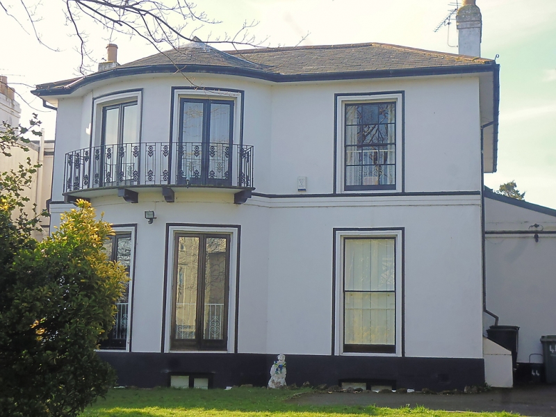
No 44 (Kent Lodge)
SZ 5992 2/48
II
2.
Circa 1830/40 villa. Two storeys stucco faced. Low pitch hipped
slate roof, eaves cornice. Three windows, two in bow through both
storeys to East, recessed, sash, no glazing bars to West windows.
Original French windows with marginal glazing bars on bow which has
anthemion balcony to first floor. Band between storeys.
Listing NGR: SZ5951292517
External links are from the relevant listing authority and, where applicable, Wikidata. Wikidata IDs may be related buildings as well as this specific building. If you want to add or update a link, you will need to do so by editing the Wikidata entry.


Other nearby listed buildings
