Latitude: 50.863 / 50°51'46"N
Longitude: -0.6303 / 0°37'48"W
OS Eastings: 496493
OS Northings: 107949
OS Grid: SU964079
Mapcode National: GBR FHX.X1H
Mapcode Global: FRA 96KT.J95
Plus Code: 9C2XV979+6V
Entry Name: Dairy Cottage
Listing Date: 20 September 1984
Grade: II
Source: Historic England
Source ID: 1221725
English Heritage Legacy ID: 413591
ID on this website: 101221725
Location: Slindon, Arun, West Sussex, BN18
County: West Sussex
District: Arun
Civil Parish: Slindon
Built-Up Area: Slindon
Traditional County: Sussex
Lieutenancy Area (Ceremonial County): West Sussex
Church of England Parish: Slindon St Mary
Church of England Diocese: Chichester
Tagged with: Cottage
SU 90NE SLINDON SCHOOL HILL
8/300 (west side)
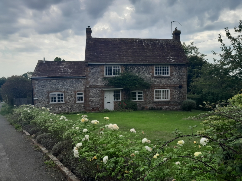
Dairy Cottage
II
Dated 1749. Two storeys. Two windows. Faced with squared knapped flints with red
brick dressings, quoins and stringcourse. Tiled roof. Casement windows. Stone with
the date 1749 and the initials M. Ground floor addition of one window to north
east. P. A.
Listing NGR: SU9649307949
External links are from the relevant listing authority and, where applicable, Wikidata. Wikidata IDs may be related buildings as well as this specific building. If you want to add or update a link, you will need to do so by editing the Wikidata entry.


Other nearby listed buildings