Approximate Location Map
Large Map »
Latitude: 51.0453 / 51°2'43"N
Longitude: 0.4152 / 0°24'54"E
OS Eastings: 569396
OS Northings: 130106
OS Grid: TQ693301
Mapcode National: GBR NSG.HS4
Mapcode Global: FRA C6RC.3LD
Plus Code: 9F322CW8+43
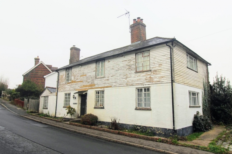
Entry Name: Chestnut House
Listing Date: 13 May 1987
Grade: II
Source: Historic England
Source ID: 1222455
English Heritage Legacy ID: 414608
ID on this website: 101222455
Location: Ticehurst, Rother, East Sussex, TN5
County: East Sussex
District: Rother
Civil Parish: Ticehurst
Built-Up Area: Ticehurst
Traditional County: Sussex
Lieutenancy Area (Ceremonial County): East Sussex
Church of England Parish: Ticehurst St Mary
Church of England Diocese: Chichester
Tagged with: House
TQ 6830-6930
34/49
TICEHURST
LOWER PLATTS
Chestnut House
GV
II
Early C19. Two storeys. Three windows. Ground floor painted brick, above weather-boarded. Hipped slate roof. Casement windows.
Listing NGR: TQ6939630106
External links are from the relevant listing authority and, where applicable, Wikidata. Wikidata IDs may be related buildings as well as this specific building. If you want to add or update a link, you will need to do so by editing the Wikidata entry.


Other nearby listed buildings
