Approximate Location Map
Large Map »
Latitude: 51.739 / 51°44'20"N
Longitude: -2.2411 / 2°14'27"W
OS Eastings: 383449
OS Northings: 204505
OS Grid: SO834045
Mapcode National: GBR 1MJ.XY7
Mapcode Global: VH94Y.3KL7
Plus Code: 9C3VPQQ5+JH
Entry Name: Flour Mill
Listing Date: 25 June 1974
Grade: II
Source: Historic England
Source ID: 1222882
English Heritage Legacy ID: 418357
ID on this website: 101222882
Location: Dudbridge, Stroud, Gloucestershire, GL5
County: Gloucestershire
District: Stroud
Civil Parish: Rodborough
Built-Up Area: Stroud
Traditional County: Gloucestershire
Lieutenancy Area (Ceremonial County): Gloucestershire
Church of England Parish: Selsley All Saints
Church of England Diocese: Gloucester
Tagged with: Mill
SO 8504 NW; 17/464
SO 8504 SW; 19/464
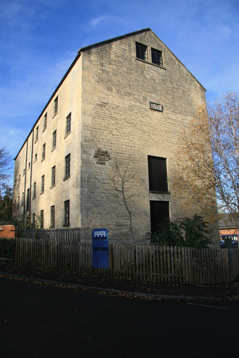
SELSLEY ROAD (West side),
DUDBRIDGE,
Flour Mill
II
1849 (date). Hammer-dressed rubble. Pitched slate roof with coped gables. Five
storeys. Seven ranges of windows. One range of loading doors. Internal iron columns
taking floors throughout.
Listing NGR: SO8344904505
External links are from the relevant listing authority and, where applicable, Wikidata. Wikidata IDs may be related buildings as well as this specific building. If you want to add or update a link, you will need to do so by editing the Wikidata entry.


Other nearby listed buildings
