Approximate Location Map
Large Map »
Latitude: 51.7485 / 51°44'54"N
Longitude: -2.2362 / 2°14'10"W
OS Eastings: 383792
OS Northings: 205560
OS Grid: SO837055
Mapcode National: GBR 1MJ.CFY
Mapcode Global: VH94Y.695Y
Plus Code: 9C3VPQX7+CG
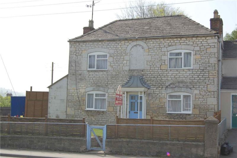
Entry Name: Felix House
Listing Date: 25 June 1974
Grade: II
Source: Historic England
Source ID: 1223138
English Heritage Legacy ID: 418696
ID on this website: 101223138
Location: Park End, Stroud, Gloucestershire, GL5
County: Gloucestershire
District: Stroud
Civil Parish: Stroud
Built-Up Area: Stroud
Traditional County: Gloucestershire
Lieutenancy Area (Ceremonial County): Gloucestershire
Church of England Parish: Cainscross St Matthew
Church of England Diocese: Gloucester
Tagged with: House
1. STRATFORD ROAD
5227
(South Side)
No 121 (Felix House)
SO 8305 NE 12/486
II
2.
Early C19. Hammerdressed rubble, Hipped slate roof. Brick chimneys. 2 storeys.
2 ranges of modern casements in original segment-headed openings. Latticework
porch with tent roof. 1 blocked round arched window above.
Listing NGR: SO8379205560
External links are from the relevant listing authority and, where applicable, Wikidata. Wikidata IDs may be related buildings as well as this specific building. If you want to add or update a link, you will need to do so by editing the Wikidata entry.


Other nearby listed buildings
