Approximate Location Map
Large Map »
Latitude: 53.9342 / 53°56'2"N
Longitude: -1.9262 / 1°55'34"W
OS Eastings: 404944
OS Northings: 448672
OS Grid: SE049486
Mapcode National: GBR GQZY.SG
Mapcode Global: WHB7H.DC0V
Plus Code: 9C5WW3MF+MG
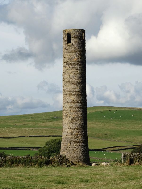
Entry Name: Old Tower
Listing Date: 25 January 1985
Grade: II
Source: Historic England
Source ID: 1223448
English Heritage Legacy ID: 418868
ID on this website: 101223448
Location: Cringles, Bradford, West Yorkshire, BD20
County: Bradford
Civil Parish: Silsden
Traditional County: Yorkshire
Lieutenancy Area (Ceremonial County): West Yorkshire
Church of England Parish: Silsden St James
Church of England Diocese: Leeds
Tagged with: Tower
SE04NW SILSDEN C.P. BOLTON ROAD
(west side) Cringles
3/124 Old Tower
II
Survey-tower. C1854-60. Coursed dressed rubble. Circular with
battered base which has doorway set in eastern face (blocked),
single lancet above. Top has 4 rectangular windows. Probably
contains a spiral-stair. Used in the construction of the Barden
Aqueduct (q.v.).Prominent in the landscape.
Listing NGR: SE0494448672
External links are from the relevant listing authority and, where applicable, Wikidata. Wikidata IDs may be related buildings as well as this specific building. If you want to add or update a link, you will need to do so by editing the Wikidata entry.


Other nearby listed buildings
