Latitude: 51.5 / 51°30'0"N
Longitude: -0.1658 / 0°9'56"W
OS Eastings: 527412
OS Northings: 179492
OS Grid: TQ274794
Mapcode National: GBR 6J.YG
Mapcode Global: VHGQZ.2KQF
Plus Code: 9C3XGR2M+2M
Entry Name: 44, Montpelier Street SW7
Listing Date: 11 May 1971
Grade: II
Source: Historic England
Source ID: 1223456
English Heritage Legacy ID: 419184
ID on this website: 101223456
Location: Knightsbridge, Westminster, London, SW7
County: London
District: City of Westminster
Electoral Ward/Division: Knightsbridge and Belgravia
Parish: Non Civil Parish
Built-Up Area: City of Westminster
Traditional County: Middlesex
Lieutenancy Area (Ceremonial County): Greater London
Church of England Parish: Holy Trinity South Kensington
Church of England Diocese: London
Tagged with: Building
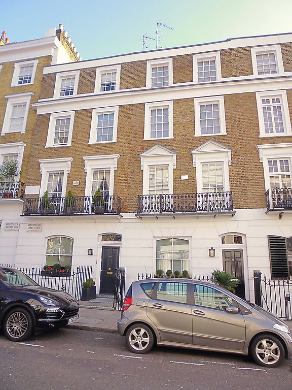
TQ 2779 SW CITY OF WESTMINSTER MONTPELIER STREET, SW7
95/49 (east side)
11.5. 71 No 44.
GV II
House. C1840. Brick, stucco dressings and channelled stucco to ground floor.
Roof not visible. Four storeys including attic, plus basement. Two windows
wide. Entrance to right. Doorway and windows square headed. Panelled door.
Stucco architraves to windows, sashed, retaining glazing bars. Cornice intact.
Cast iron balcony to first floor. Cast iron area railings.
Listing NGR: TQ2741279492
External links are from the relevant listing authority and, where applicable, Wikidata. Wikidata IDs may be related buildings as well as this specific building. If you want to add or update a link, you will need to do so by editing the Wikidata entry.


Other nearby listed buildings