Approximate Location Map
Large Map »
Latitude: 50.7651 / 50°45'54"N
Longitude: -1.2988 / 1°17'55"W
OS Eastings: 449546
OS Northings: 96404
OS Grid: SZ495964
Mapcode National: GBR 89K.VVS
Mapcode Global: FRA 8752.1V0
Plus Code: 9C2WQP82+2F
Entry Name: Harbour House
Listing Date: 9 August 1979
Grade: II
Source: Historic England
Source ID: 1223777
English Heritage Legacy ID: 419635
ID on this website: 101223777
Location: Cowes, Isle of Wight, PO31
County: Isle of Wight
Civil Parish: Cowes
Built-Up Area: Cowes
Traditional County: Hampshire
Lieutenancy Area (Ceremonial County): Isle of Wight
Church of England Parish: West Cowes Holy Trinity
Church of England Diocese: Portsmouth
Tagged with: House
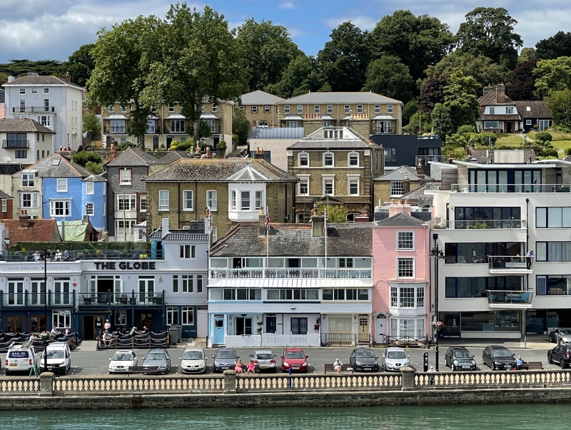
VICTORIA PARADE
1.
5270
West Cowes
Harbour House
SZ 4996 SE 1/109
II GV
2.
Early C19. Painted brick with hipped slate roof. Four storeys. One window.
Eaves cornice. Glazing bars intact above ground floor. Bay on ground and
1st floors with cornice over. Doorcase with pilasters, pediment, semi-circular
fanlight and 6-panelled door.
Listing NGR: SZ4954696404
External links are from the relevant listing authority and, where applicable, Wikidata. Wikidata IDs may be related buildings as well as this specific building. If you want to add or update a link, you will need to do so by editing the Wikidata entry.


Other nearby listed buildings
