Approximate Location Map
Large Map »
Latitude: 50.678 / 50°40'40"N
Longitude: -3.4621 / 3°27'43"W
OS Eastings: 296792
OS Northings: 87498
OS Grid: SX967874
Mapcode National: GBR P3.3SNB
Mapcode Global: FRA 37M8.YX6
Plus Code: 9C2RMGHQ+55
Entry Name: Wall and Piers of No 40
Listing Date: 18 June 1974
Grade: II*
Source: Historic England
Source ID: 1224110
English Heritage Legacy ID: 420048
Also known as: Wall and Piers of No 40, The Stand
ID on this website: 101224110
Location: Topsham, Exeter, Devon, EX3
County: Devon
District: Exeter
Electoral Ward/Division: Topsham
Parish: Non Civil Parish
Built-Up Area: Topsham
Traditional County: Devon
Lieutenancy Area (Ceremonial County): Devon
Church of England Parish: Topsham St Margaret
Church of England Diocese: Exeter
Tagged with: Wall
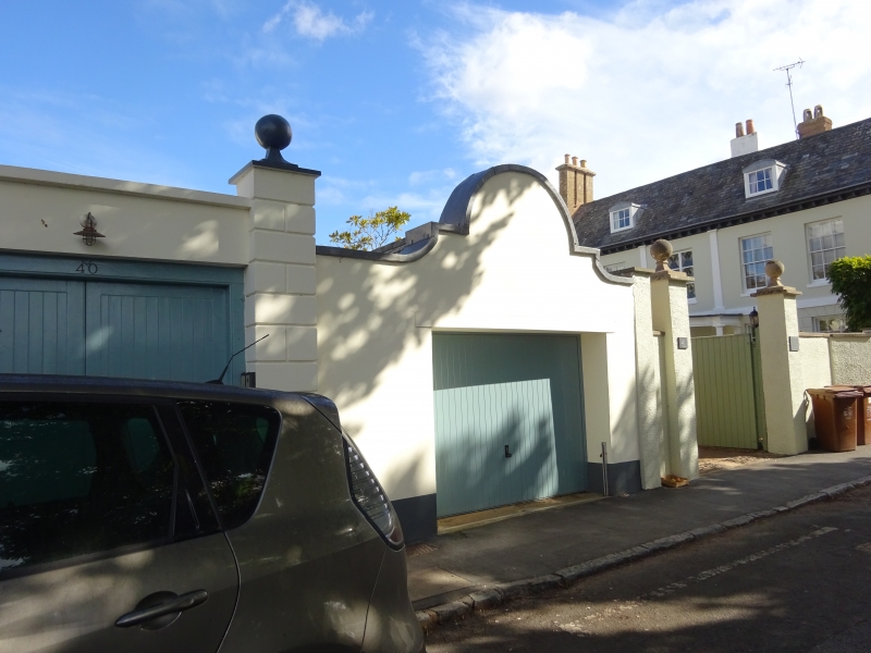
THE STRAND
1.
1092
(East Side)
TOPSHAM
Wall and Piers of No 40
SX 9688 9/1186A
II* GV
2.
C18. Rendered wall and rusticated piers with ball finials.
All the listed buildings of the Strand form a group.
Listing NGR: SX9679287498
External links are from the relevant listing authority and, where applicable, Wikidata. Wikidata IDs may be related buildings as well as this specific building. If you want to add or update a link, you will need to do so by editing the Wikidata entry.


Other nearby listed buildings
