Approximate Location Map
Large Map »
Latitude: 50.7138 / 50°42'49"N
Longitude: -1.9883 / 1°59'17"W
OS Eastings: 400922
OS Northings: 90463
OS Grid: SZ009904
Mapcode National: GBR XQ5.RT
Mapcode Global: FRA 67Q6.37H
Plus Code: 9C2WP276+GM
Entry Name: 3, Market Street
Listing Date: 14 June 1954
Grade: II
Source: Historic England
Source ID: 1224180
English Heritage Legacy ID: 412531
ID on this website: 101224180
Location: Old Town, Bournemouth, Christchurch and Poole, Dorset, BH15
County: Bournemouth, Christchurch and Poole
Parish: Non Civil Parish
Built-Up Area: Poole
Traditional County: Dorset
Lieutenancy Area (Ceremonial County): Dorset
Church of England Parish: Poole St James with St Paul
Church of England Diocese: Salisbury
Tagged with: Building
POOLE
SZ0090SE MARKET STREET
958-1/17/84 (South East side)
14/06/54 No.3
GV II
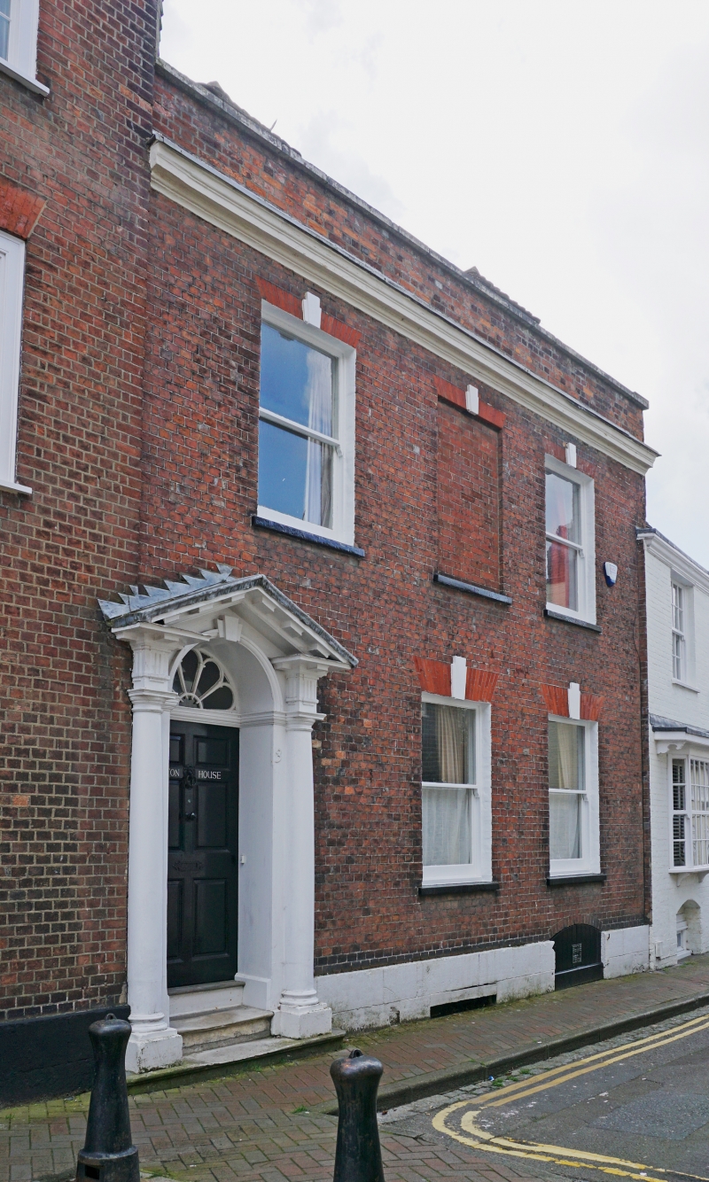
Formerly known as: Lawton House MARKET STREET.
House. Late C18. Header bond brick with gauged brick arches,
ashlar plinth, tile-hung gable and a hipped tiled roof.
Double-depth plan.
2 storeys, attic and basement; 3-window range. Plinth, cornice
and parapet, left-hand round-arched doorway has attached Doric
columns to open modillion pediment, keyed arch, good fanlight
and 6-panel door; flat gauged brick arches with split keys to
plate-glass sashes, with blind central first-floor window.
Segmental-arched right-hand cellar door, and 2 hipped dormers
with cheekboards.
INTERIOR largely altered late C20; original HL hinges to front
door, rebuilt central lateral stair.
(RCHME: County of Dorset (South East): London: 1970-: 228).
Listing NGR: SZ0092290462
External links are from the relevant listing authority and, where applicable, Wikidata. Wikidata IDs may be related buildings as well as this specific building. If you want to add or update a link, you will need to do so by editing the Wikidata entry.


Other nearby listed buildings
